Forest Road 227: Driving the 3,000m Plateau in Duchesne County
Reaching an elevation of 3,165m (10,383ft) above sea level, Forest Road 227 is a high-altitude mountain track in Duchesne County, Utah. Located within the Ashley National Forest, the road is notable for running its entire length at elevations exceeding 3,000 meters, making it one of the highest sustained forest routes in the region.
| Road facts: Forest Road 227 | |
|---|---|
| Location | Duchesne County, Utah, USA |
| Max Elevation | 3,165 m (10,383 ft) |
| Length | 14.16 km (8.8 miles) |
| Elevation Gain | 735 meters (2,411 ft) |
| Avg Gradient | 5.20% |
How is the road to Center Park Trailhead?
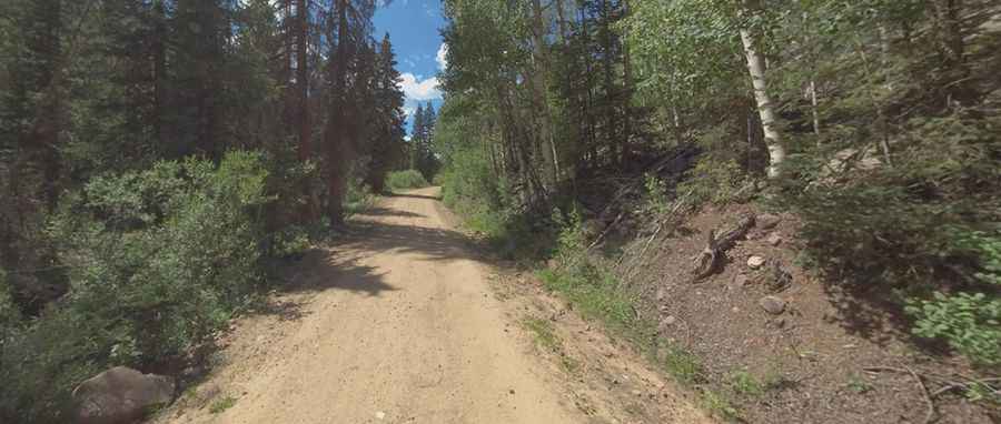
The road follows a south-north axis, starting from the junction with FR119 and ending at the parking lot for the Center Park Trailhead. The 14.16 km (8.8 miles) route is entirely unpaved. As seen on the ground, the surface is composed of fine-packed dirt and forest gravel, winding through dense stands of spruce and pine. While the average gradient is 5.20%, the sustained high altitude puts significant stress on vehicle aspiration. A high-clearance 4x4 vehicle is mandatory to navigate sections with deep ruts and the soft shoulders typical of the Ashley National Forest tracks.
Is Forest Road 227 open in winter?
No. Due to its extreme elevation, the road is impassable from October to June. The track suffers from brutal meteorological conditions, with heavy snow accumulation and temperatures that drop well below freezing. Even during the summer months, sudden snowstorms can occur, turning the dirt surface into a slippery mud trap. Drivers should only attempt this route when the ground is dry, as the clay content in the soil makes traction nearly impossible for standard tires after rainfall.
What are the main hazards on FR 227?
The primary hazards are hypoxia, blind corners, and total isolation. At over 3,000 meters, engine power is reduced by approximately 30%, which can affect throttle response during technical maneuvers. The road is narrow and features tight bends with limited visibility due to the thick forest growth. There are no safety barriers, and the higher sections are exposed to high winds. Wildlife, including elk and mule deer, are frequently present on the track, making constant speed modulation essential to avoid collisions on the blind sections of the 14.16 km climb.
Logistics and Technical Preparation
This is a remote wilderness drive with no services, fuel, or water. Mobile signal is non-existent for the majority of the route. Before departing, ensure your vehicle's cooling system is in top condition and carry a full-size spare tire. The sharp rocky debris on FR 227 is prone to causing punctures. Due to the brutally cold temperatures and isolation, it is recommended to travel with emergency blankets and basic recovery gear (shovel and tow straps), as assistance can be many hours away in this part of Duchesne County.
Pic: Shannon Bushman