How to drive the unpaved road to Mill Creek Road in Colorado?
Mill Creek Road (FSR 710) is a high mountain road located in Eagle County, in the US state of Colorado. It’s one of the highest roads in Colorado.
Where is Mill Creek Road?
The road is located in the north-central part of Colorado, within the White River National Forest.
Is Mill Creek Road unpaved?
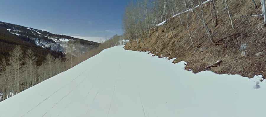
The road is totally unpaved. It’s a service road for the chairlifts of Vail Ski Resort. 4x4 vehicles only. The road is very steep and comprises 19 hairpin turns. It’s a long dirt road climb to a spectacular summit.
How long is Mill Creek Road?
Starting from Eagles Nest, the road is 9.2 miles long. It’s open to authorized vehicles only. The views are spectacular and just get better and better all the way to the top.
Is Mill Creek Road open year-round?
The road ends at 3.607m (11,833ft) above sea level. It’s totally impassable in winters, usually from October to June.
Mill Creek Road (FSR 710) is a high mountain road located in Eagle County, in the US state of Colorado. It’s one of the highest roads in Colorado. Where is Mill Creek Road? The road is located in the north-central part of Colorado, within the White River National Forest. Is Mill Creek Road unpaved? The road is totally unpaved. It’s a service road for the chairlifts of Vail Ski Resort. 4x4 vehicles only. The road is very steep and comprises 19 hairpin turns. It’s a long dirt road climb to a spectacular summit. How long is Mill Creek Road? Starting from Eagles Nest, the road is 9.2 miles long. It’s open to authorized vehicles only. The views are spectacular and just get better and better all the way to the top. Is Mill Creek Road open year-round? The road ends at 3.607m (11,833ft) above sea level. It’s totally impassable in winters, usually from October to June.