How long is the Donner Summit Bridge in California?
The Donner Summit Bridge (also known as Rainbow Bridge) is a historic concrete arch bridge spanning 73.5 meters (241 ft) in Nevada County, California, USA. Located in the northern Sierra Nevada mountains at an elevation of 2,108 meters (6,916 ft) above sea level, the bridge carries the paved Old Donner Pass Road high above Donner Lake. Itos one of the most spectacular bridges in the world along Donner Pass.
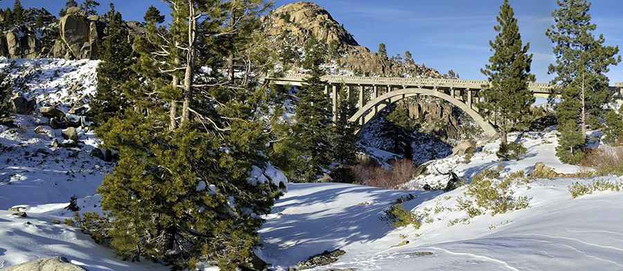
| Road facts: Donner Summit Bridge (Rainbow Bridge) | |
|---|---|
| Location | Nevada County (Donner Pass), California (USA) |
| Route Designation | Old Donner Pass Road (Lincoln Highway) |
| Length | 73.5 m (241 ft) |
| Elevation | 2,108 m (6,916 ft) above sea level |
| Structure Type | Reinforced concrete arch (Curved deck with a gradual grade) |
| Build Date / Restoration | Built 1926 / Fully restored 1993 |
| Surface | Fully paved asphalt |
| Access Status | Open in summer; subject to heavy winter snow closures |
Where is the Donner Summit Bridge located?
The bridge sits along Old Donner Pass Road in the Sierra Nevada, just west of Truckee and north of Lake Tahoe. Positioned at 2,108 meters elevation, the structure spans a granite gap overlooking the eastern descent toward Donner Lake.
What type of bridge carries Old Donner Pass Road?
Constructed in 1926 by the US Bureau of Public Roads and the California Highway Commission, it was the first bridge of its kind to be built with both a compound curve and a continuous grade across the arch. The 241-foot reinforced concrete arch structure underwent a full restoration in 1993 to preserve its frame and concrete balustrades.
Is the road over Donner Summit Bridge paved?
Yes. Old Donner Pass Road is completely paved with asphalt. The route forms part of the historic Lincoln Highway alignment, climbing steep mountain grades to reach the summit pass.
What are the driving hazards on the Donner Summit Bridge?
Because the bridge sits at nearly 7,000 feet, winter brings massive snowfall, high winds, and severe ice accumulation. The curved concrete deck loses thermal energy quickly, creating black ice conditions. While Interstate 80 handles primary highway traffic nearby, this mountain road experiences frequent seasonal closures during heavy Sierra winter storms.
Pic: Vasiliy Bachinsky