What are the most challenging National Park roads to drive in the USA?
Driving through the US National Park system involves more than just scenic overlooks; it requires managing high-altitude climbs, unpredictable weather, and technical mountain passes. While these routes are paved, the sheer scale of the terrain and the proximity to unprotected drops make them a test for any driver. Navigating these parks means accounting for heavy tourist traffic, brake fade on long descents, and sudden seasonal closures that can block key mountain arteries for months.
| National Park Roads: Driving Hazards | |
|---|---|
| Trail Ridge Road | 3,713m elevation, no guardrails, high winds. |
| Tioga Pass | Extreme snowfall, steep Sierra Nevada grades. |
| Scenic Byway 12 | Narrow "The Hogback" ridge, sheer drops. |
| Blue Ridge Parkway | Fog, heavy traffic, continuous curves. |
How dangerous is the Trail Ridge Road in the Rocky Mountains?
The Trail Ridge Road is the highest continuous paved highway in the United States, reaching a peak of 3,713m (12,183ft). The primary challenge is the lack of guardrails along massive stretches of the route. Drivers with vertigo will find the exposed ledges particularly difficult, as the road clings to the tundra with nothing between the tires and the valley floor. High-altitude winds are constant, and the thin air causes a noticeable drop in engine power. Snow can fall at the summit even in July, requiring immediate adjustments to speed and braking distance.
What are the driving risks on Tioga Pass in Yosemite?
Reaching an elevation of 3,031m (9,943ft), Tioga Road is a high-altitude grind through the Sierra Nevada. The road features steep gradients that can quickly overheat the brakes of heavy campers and SUVs on the descent toward Mono Lake. The pass is seasonally impassable for much of the year, often buried under meters of snow from November until late May or June. Driving this pass in the early or late season means dealing with black ice in shaded corners and the risk of being stranded by a sudden mountain storm.
What is "The Hogback" on Utah’s Scenic Byway 12?
The Scenic Byway 12, connecting Bryce Canyon and Capitol Reef, features one of the most technical sections of road in the American Southwest: The Hogback. This stretch of asphalt is paved along a razor-thin ridge with steep, unprotected drops on both sides of the narrow lanes. There is no shoulder and no room for error. Strong crosswinds can push a high-profile vehicle toward the edge, making it one of the most psychologically demanding drives for those heading through the Grand Staircase-Escalante area.
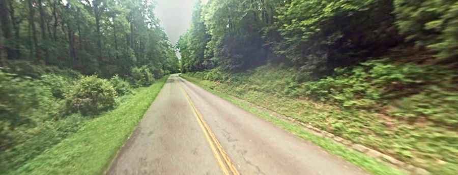
What makes the Blue Ridge Parkway a high-fatality route?
Despite its lower altitude compared to Western parks, the Blue Ridge Parkway is hazardous due to its design and usage. The road is a continuous series of curves with no straightaways for long distances, which leads to driver fatigue. Frequent heavy fog reduces visibility to a few meters in minutes, turning the narrow lanes into a trap for those unfamiliar with the terrain. The high volume of tourist traffic, combined with the lack of lighting and the presence of wildlife on the road at night, makes it a route where mechanical and situational awareness is mandatory.