Bitterroot-Big Hole Road is a Very Scenic Drive in Montana
Located in the U.S. state of Montana, Bitterroot-Big Hole Road is a very exciting journey through history. It is a narrow one-lane road.
Where is the Bitterroot-Big Hole Road?
The road straddles Beaverhead and Ravalli counties, in the southwestern part of Montana.
When Was the Bitterroot-Big Hole Road Built?
Tucked away in the Rocky Mountains, within the Bitterroot National Forest, the road was built in 1914. It was used by part of the Lewis and Clark Expedition on their return trip. This pass played a role in the Lewis and Clark Expedition's journey across the continent. Read more about their discoveries and the routes that became today's roads: From Expedition Routes to Asphalt: Lewis and Clark's Mountain Pass Discoveries.
How Long is the Bitterroot-Big Hole Road?
It’s 26.55km (16.5 miles) long and runs north-south from US-93 Road, south of Sula, to Lost Trail Pass, a high mountain pass at an elevation of 2,143m (7,030ft) above sea level, located on the border between Idaho and Montana.
Is the Bitterroot-Big Hole Road Unpaved?
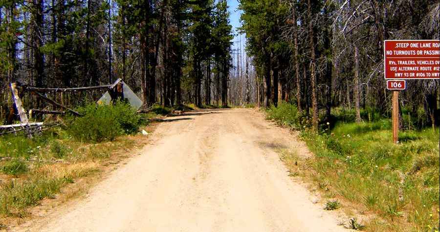
The Bitterroot-Big Hole Road (Forest Road 106) is totally unpaved. It’s a steep, winding, and narrow road with few turnouts and is not suitable for vehicles over 25 feet, trailers, or those with low clearance. The drive will take some skill, some patience, and some tolerance for vertigo. Watch for soft shoulders (especially near those 100 ft drop-offs), falling rocks, and fallen trees or rocks on the road. In places, the side hill drops off several hundred feet, and driving can be nerve-wracking. Take along a good spare tire, not just a temporary one. It shouldn’t be attempted by those who don't know how to reverse. If you meet oncoming traffic, be prepared to back up for some distance.
How High Does the Bitterroot-Big Hole Road Climb?
It’s locally known as Gibbons Pass Road. It’s a mountain road, topping out at 2,246m (7,368ft) above sea level. Remember that vehicles traveling uphill have the right-of-way. The road climbs up to Gibbons Pass, at an elevation of 2,117m (6,945ft) above sea level. Named for Colonel John Gibbon, it’s one of the most historic passes in Montana.