Clear Creek Trail: Driving the steep 8% 4x4 climb in the Anaconda Range
Tucked away at the foot of the Anaconda Range in southwestern Montana, Clear Creek Trail is a high mountain road that demands respect from any off-road driver. Reaching a peak elevation of 2,602m (8,536ft) above sea level, this route in Deer Lodge County is a relentless climb through some of the most rugged terrain in the state.
| Road facts: Clear Creek Trail | |
|---|---|
| Location | Deer Lodge County, Montana, USA |
| Max Elevation | 2,602 m (8,536 ft) |
| Length | 10.94 km (6.8 miles) |
| Elevation Gain | 910 m |
| Average Gradient | 8.31% |
Where is the Clear Creek Trail?
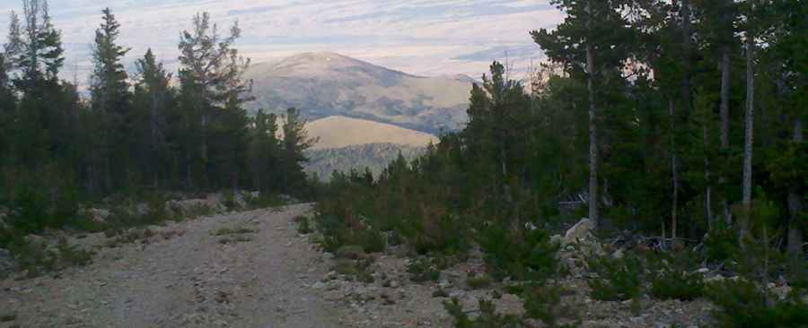
The road is located in the southwestern part of Montana, starting from the paved Mill Creek Road. As soon as you leave the asphalt, the geography changes into a steep mountain environment. The trail follows the natural contours of the Anaconda Range, climbing through thick forests and over rocky ridges. This is a remote area where self-sufficiency is key; there are no services nearby, and the isolation means you should be prepared for any mechanical or weather-related issues during the ascent.
Is the Clear Creek Trail unpaved?
Yes, the Clear Creek Trail is entirely unpaved, consisting of a mix of gravel and large rocks. In many parts, the track becomes treacherous, with deep ruts and loose stones that can easily cause a loss of traction. A 4x4 vehicle is strictly required to navigate the steep ramps and uneven surface. Because the soil is high-mountain dirt, you should only travel on this road when it is dry. If it rains, the trail becomes a slippery mess that makes it nearly impossible to maintain control on the 8% slopes.
How long is the road to the Clear Creek Trail summit?
Starting from Mill Creek Road, the track spans 10.94 km (6.8 miles). Don't let the distance deceive you; over these 11 kilometers, the road overcomes an elevation gain of 910 meters. This results in a sustained average gradient of 8.31%. This is a very steep road that will put your engine and cooling system to the test. You'll likely spend much of the drive in low-range gears, picking your lines carefully to avoid the most "treacherous" rocky sections while keeping enough momentum to clear the constant incline.
What are the weather hazards at Clear Creek Trail?
At an elevation of over 2,600 meters, altitude and extreme weather are factors every day of the year. Weather conditions in the Anaconda Range can change quickly and be harsh; a clear morning can turn into a technical blizzard or a heavy thunderstorm in minutes. Road closures are frequent, especially in the shoulder seasons when snowdrifts block the higher elevations. Even in the middle of summer, temperatures can drop rapidly at the summit. Always check the local forecast for Deer Lodge County before starting your trip, and never underestimate the potential for a sudden storm to turn a rocky climb into a survival situation.
Pic: William Pantano