How to drive the unpaved road to Silvertip Basin in Wyoming
Silvertip Basin is a high mountain peak at an elevation of 3.241m (10,633ft) above sea level, located in Park County, in the US state of Wyoming. It’s one of the highest roads of Wyoming.
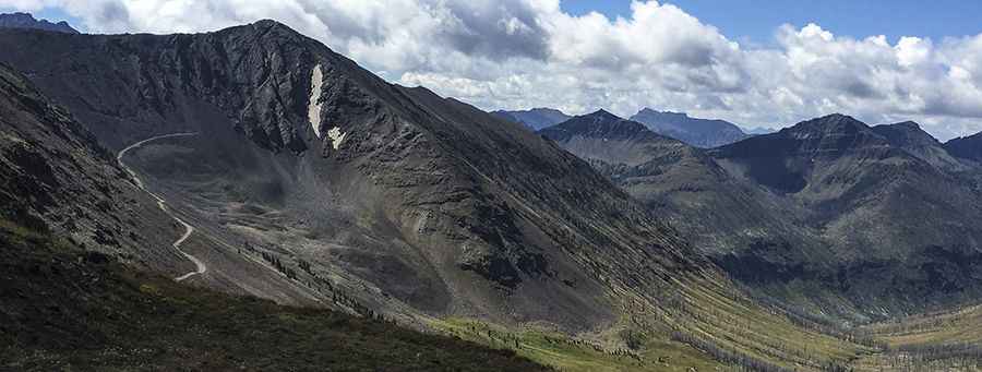
Where is Silvertip Basin?
The peak is located in the northwestern part of Wyoming, within the Shoshone National Forest.
Is the road to Silvertip Basin unpaved?
The rough road to the summit is totally unpaved. It’s called Forest Road 1013I. It’s an old mining road, with narrow parts, steep sections and 12 sharp hairpin turns.
How long is the road to Silvertip Basin?
Starting from Forest Road 101 (Sunlight Road), the road to the summit is 9.01km (5.6 miles) long. Over this distance, the elevation gain is 936m (3,071 ft) and the average gradient is 10.38%.
How to drive the unpaved road to Hughes Basin in Wyoming
On the way to the summit, the road climbs up to Hughes Basin, a high mountain pass at an elevation of 3.154m (10,347ft) above sea level.
Is the road to Silvertip Basin open year-round?
Set high in the Absaroka Range, the road is not plowed in winters.
Pic: Scott Richard