Galena Summit is one of the highest paved roads of Idaho
Galena Summit is a high mountain pass at an elevation of 2,660m (8,727ft) above sea level, located in the U.S. state of Idaho.
Where is Galena Summit?
The pass is located on the northwest corner of Blaine County within the Sawtooth National Recreation Area of the Sawtooth National Forest. The pass is named after Galena, a mineral.
How long is the road to Galena Summit in Idaho?
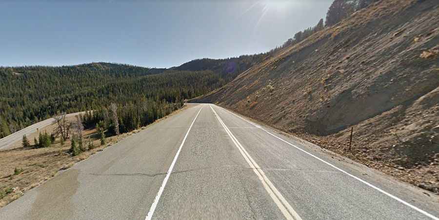
The road to the summit is entirely paved with a few turns and is pretty steep in parts. It’s called State Highway 75 (Sawtooth Scenic Byway). The pass is 125km (78.0 miles) long, running north-south from Stanley, a town in Custer County, to Bellevue, a city in Blaine County in the central part of the state.
When was the road to Galena Summit in Idaho built?
Located in central Idaho, the first road through Galena Summit was completed in 1881 to serve the mines located at Vienna and Sawtooth City near present-day Smiley Creek. Portions of the old road can still be seen today.
Is the road to Galena Summit in Idaho open?
Set high in the Boulder Mountains, access to the pass is typically open all year round, but winter weather may cause restrictions and closures due to dangerous weather conditions. It is the highest summit of a highway in the Northwest and is subject to winter snowfalls.
Is the road to Galena Summit in Idaho worth it?
The drive is scenic and offers great views. It provides gorgeous panoramic views of the surrounding mountains. The road is among the most iconic climbs in Idaho. A little more than 1 mile (1.6 km) west of the summit is Galena Overlook, a scenic viewpoint at 8,400 feet (2,560 m) now known as the Bethine and Frank Church Overlook. The best views are near sunset and sunrise. Watch out for animals along the way.