Can I drive to Cerro Rubio in New Mexico?
Cerro Rubio is a high mountain peak at an elevation of 3.002m (9,849ft) above sea level, located in Los Alamos County, in the US state of New Mexico.
Where is Cerro Rubio?
The peak is located west of Los Alamos, in north central New Mexico, within the Santa Fe National Forest, north of Pajarito Mountain.
Is the road to Cerro Rubio unpaved?
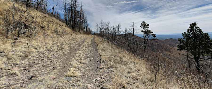
The road to the summit is totally unpaved. It’s a narrow, unpaved two-track dirt road running along an exposed ridge, surrounded by dry grass and dead, fire-damaged trees.
How long is the road to Cerro Rubio?
Starting from Los Alamos, the road to the summit is 9.17km (5.7 miles) long. Over this distance, the elevation gain is 701m (2,300 ft) and the average gradient is 7.64%.
Can I drive to Cerro Rubio?
The drive to the summit is divided into two sections. Starting at Los Alamos, the route follows Pipeline Road, a rough 2.9-mile track restricted to 4x4 vehicles. The final 2.8 miles along Quemazon Trail are barred to private motorized traffic. Closed by gates, this restricted section retains the width and appearance of a primitive forest track, but access is strictly limited to hikers, mountain bikers, and horseback riders. The terrain features steep inclines covered in loose dirt and heavy rocks.
Is the road to Cerro Rubio open year-round?
Set high in the Jemez Mountains, the road is not plowed in winters.
Pic: Jiří Čertík