Summit Camp: Driving the Brutal 30% Ski Ramps in New Mexico
Summit Camp is a high-altitude mountain peak reaching an elevation of 3,134 meters (10,282 ft) above sea level in Taos County, New Mexico. Located within the Carson National Forest and the Sangre de Cristo Mountains, the track to the summit is a steep, unpaved service road built for ski resort chairlift maintenance.
| Road facts: Summit Camp | |
|---|---|
| Location | Taos County, New Mexico, USA |
| Elevation | 3,134 m (10,282 ft) |
| Length | 4 km (2.48 miles) from Red River |
| Max Gradient | Exceeds 30% |
| Surface | Unpaved dirt and crushed rock |
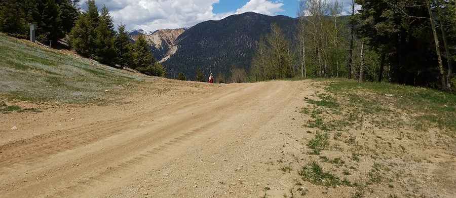
How steep is the 4-km climb from Red River to Summit Camp?
The unpaved mountain route climbs for 4 kilometers starting from the mountain town of Red River. Over this short distance, the track gains 500 vertical meters, placing it among the highest mountain roads of New Mexico. The average slope is a stiff 12.5%, but the hardest sections hit ramps that exceed a brutal 30% gradient. The surface is a raw mix of loose dirt and crushed rock shards. Climbing these vertical ski slopes requires a low-range four-wheel-drive system.
Why is the Summit Camp track restricted to authorized 4x4 vehicles?
The route was cut directly into the mountain face to allow heavy maintenance machinery to reach the ski lift stations. Private vehicles are blocked by security gates. The lane is narrow and tightly hemmed in by the heavy pine forests of the Carson National Forest. On a 30% unpaved ramp, there are no passing bays or flat spaces to recover traction.
How do winter weather and high altitude affect the Summit Camp road?
At an elevation of over 3,100 meters, the peak is buried under heavy snowdrifts and sheets of thick ice for most of the year, keeping the track completely impassable until the summer maintenance window. Sudden summer afternoon thunderstorms turn the dry dirt into a slick mud trench. Heavy utility trucks leave deep ruts that scrape the undercarriage of standard vehicles.
Pic: Forrest Nichols