Devils Head
Devils Head is a lava dome at an elevation of 2.786m (9,140ft) above the sea level, located in Coconino County, in the north central part of the U.S. state of Arizona. It’s one of the highest mountain roads of Arizona.
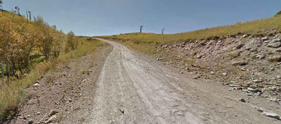
The road to the summit, located within the Coconino National Forest, is gravel, rocky, tippy and bumpy at times. It’s called Forest Road 557A. The road is usually impassable in winters. Great trail for experienced wheelers. At the summit there are several communication towers. The journey offers a great view of Flagstaff, San Francisco Mountain and northern AZ.
Avoid driving in this area if unpaved mountain roads aren't your strong point. 4x4 required. Stay away if you're scared of heights. Expect a trail pretty steep. Wet conditions may make for tough driving along the muddy road. Definitely worth a visit, especially during autumn! Conditions vary considerably depending on how recently a road grader has been through. At any time of year be ready for on-coming vehicle traffic on the narrow and curvy road. The road itself is graded and not too rough, but it has some nice switchbacks and hairpin turns, so be careful because you will be sharing the road with other vehicles and mountain bikers at times. Near the top of the climb you'll walk through an area devastated by a huge wildfire in 1977.