How to drive the unpaved road to the lookout at O'Leary Peak in Arizona?
O'Leary Peak is a mountain peak at an elevation of 2.697m (8,848ft) above sea level, located in Coconino County, in the US state of Arizona.
Where is O'Leary Peak?
It’s an extinct Pleistocene lava dome volcano located 20 miles north of Flagstaff, in the northern part of Arizona, within the Sunset Crater Volcano National Monument.
Why is there a road to O'Leary Peak?
At the summit there is a lookout tower. It offers good views of the San Francisco Peaks and Mt Elden.
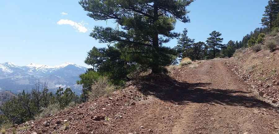
Is the road to O'Leary Peak unpaved?
The road to the summit is rough with pot holes, rocks and eroded sections. It’s called Forest Service Road 545A. The road switchbacks up to the summit, servicing the lookout tower. There are a total of 6 switchbacks to the tower.
How long is the road to O'Leary Peak?
Starting from Loop Road, the road to the summit is 8.36km (5.2 miles) long. Over this distance, the elevation gain is 616m (2,021 ft) and the average gradient is 7.36%.
Can I drive the road to O'Leary Peak?
The track to the summit is actually an old jeep road closed to vehicle traffic other than for official Forest Service use. It’s blocked with a gate near O'Leary Campground. Be prepared for abrupt weather changes; weather extremes are not uncommon.
Pic: Alex Hayden