Is the road to West Mountain in Utah difficult to drive?
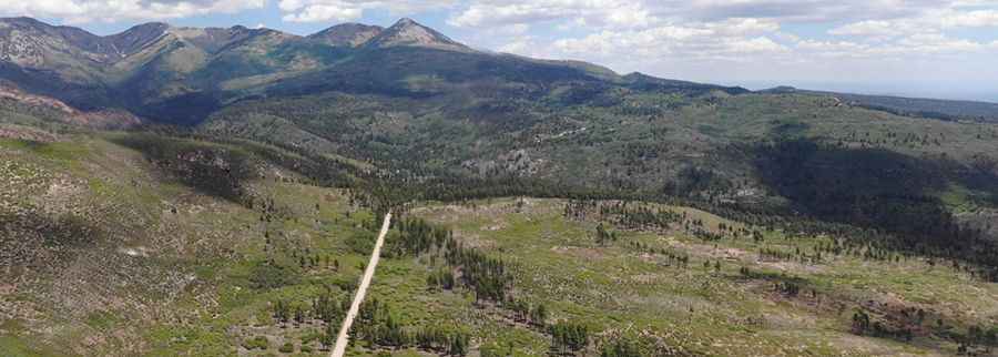
Reaching the summit of West Mountain is a journey into the wild, high-altitude heart of San Juan County. At 3,314m (10,872ft) above sea level, this peak in the Blue Mountains (Abajo Mountains) is one of the highest roads of Utah. This isn't a quick detour from the highway; it’s a rugged backcountry climb where the air gets thin and the track gets nasty as you leave the red rocks behind for the alpine peaks.
| Road facts: West Mountain | |
|---|---|
| Location | San Juan County, Utah (USA) |
| Elevation | 3,314m (10,872ft) |
| Road Name | Forest Road 0354 |
| Length | 16.3 miles (from Monticello) |
| Surface | Gravel / Steep / 4WD Required |
How long is the road to West Mountain?
The drive from Monticello to the summit spans 16.3 miles of twisting mountain track. The route takes you through the scenic but demanding North Creek Pass, where the elevation changes are constant and punishing for your transmission. You’ll be dealing with significant climbs and descents as the road carves through the Abajo range. It’s a slow-going journey where you’ll spend most of your time in low gears, watching the temperature gauge as your engine fights for oxygen at nearly 11,000 feet.
Is the road to West Mountain unpaved?
The entire route via Forest Road 0354 is strictly unpaved. The surface is a mix of gravel, packed dirt, and sections of "washboards" that will rattle your teeth if you drive too fast. In the higher stretches, the road becomes steep and rough, with loose rocks that can easily shred a standard street tire. A high-clearance 4WD vehicle is mandatory here. If you try this in a low-slung crossover, you’ll likely end up bottoming out or damaging your oil pan on the ruts left by previous storms.
What are the hazards when driving to West Mountain?
The main danger on West Mountain isn't just the steepness; it’s the isolation and the weather. During the summer, sudden afternoon thunderstorms can turn the dirt into a slippery clay trap in minutes. In the winter and spring, the road is buried under massive snowdrifts, making it impassable until well into June or July. Because it’s a Forest Service road, maintenance is minimal. You might encounter fallen trees, rockslides, or deep washouts after a heavy rain. There are no services, no gas, and no cell signal once you get deep into the blues, so you need to be 100% self-sufficient.
Is the drive to West Mountain worth the effort?
If you can handle the bumps, the views from the top are some of the best in the Four Corners region. You can see all the way into Colorado and Arizona from the summit. The road passes through beautiful groves of aspen and pine, but your main focus should stay on the track. The edges are soft, and in many places, there is barely enough room for two vehicles to pass. If you meet someone coming the other way on a narrow ledge, someone is going to have to back up. Check your spare tire, bring plenty of water, and focus on the road. Utah’s high country is beautiful, but it doesn't give second chances to those who come unprepared.
Driving the Abajo Mountains is a masterclass in backcountry focus. The road to West Mountain is a raw, unpolished experience that shows you the rugged side of San Juan County. Respect the steep grades, watch for wildlife crossing the track, and keep your lights on for visibility. The desert below is hot, but up here, the mountain rules. Stay sharp and enjoy the altitude.
Pic: Chandler Newby