How to drive the Success Loop Scenic Drive in eastern Nevada?
Success Loop Scenic Drive is a very enjoyable scenic drive nestled in the deliciously remote high-elevation mountains of White Pine County, in the US state of Nevada.
How long is Success Loop Scenic Drive in Nevada?
The road is located in the eastern part of Nevada. It’s 53.4 km (33.2 miles) long and comprises parts of Nevada State Route 486, White Pine County Rd 29, and NF-423.
Where does Success Loop Scenic Drive start and end?
The road begins at the junction of Highway 93, seven miles to the south of Ely, and ends 5 miles north of the town of McGill on Highway 93.
Is Success Loop Scenic Drive paved?
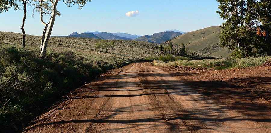
It is mostly paved. After about 15 miles, the road turns to gravel and begins a moderately steep ascent up to a pass called Success Summit. It is a well-graded dirt road.
Is Success Loop Scenic Drive open in winter?
It tops out at 2,854 m (9,363 ft) above sea level. The paved portion of the road is open all year. However, during the winter, the upper elevations of the road that cross Success Summit are closed.
Is Success Loop Scenic Drive in Nevada worth the drive?
This wonderful drive runs through the Schell Creek Range and provides stunning views throughout its entire length. Traffic on the Success Loop Scenic Drive is usually light.
Pic: Dave Eldredge