How to get by car to McGee Mountain in California?
McGee Mountain is a high mountain peak at an elevation of 3.204m (10,511ft) above sea level, located in Mono County, in the US state of California. It’s one of the highest roads in California.
Where is McGee Mountain?
The peak is located on the border of the John Muir Wilderness and the Inyo National Forest, in the northern part of California, near the Nevada border.
How challenging is the road to McGee Mountain?
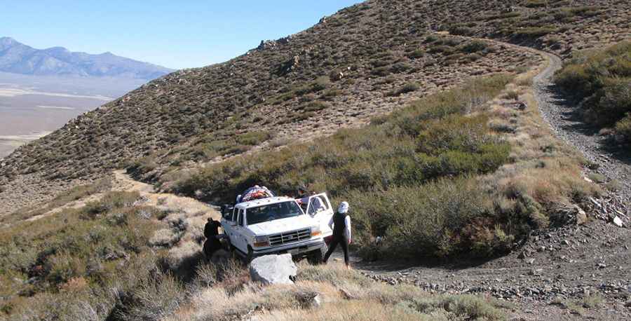
The unpaved road to the summit is really rough, with 12 hairpin turns and loose volcanic rocks. It’s usually known as McGee Mountain Road. It’s a very steep, maintained (jeep) trail that switchbacks up the north slope from Tobacco Flat to the large hanging valley a few hundred feet below the summit. The further up you travel, the worse the road becomes.
How long is the road to McGee Mountain?
Starting from the paved US-395, the road to the summit is 10.3 km (6.4 miles) long. Over this distance, the elevation gain is 1,041 m and the average gradient is 10.1%.
Is the road to McGee Mountain open in winter?
Set high in the Eastern Sierra, the route is snow-free from June to October. Always be prepared for winter weather, even in summer.
Pic: Ivan Martinetti