Hagerman Pass is a beautiful, though not easy, drive in Colorado
Hagerman Pass is a high mountain pass, at an elevation of 3,657m (11,998ft) above sea level, located on the boundary between Pitkin and Lake counties in the U.S. state of Colorado. The road is not particularly difficult, but a 4x4 vehicle is recommended. It's one of the highest roads in Colorado.
Where is Hagerman Pass?
The pass is located near Leadville, within the Pike and San Isabel National Forests in the central part of Colorado. It was named after James J. Hagerman, the builder of the Colorado Midland Railroad.
How long is the road to Hagerman Pass?
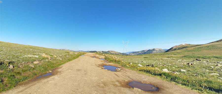
The road to the summit is totally unpaved. It's called Forest Road 105 (Hagerman Pass Road). The pass road is 18.82 km (11.7 miles) long, running from Turquoise Lake Road to Frying Pan Road. It's a great way to get from the Leadville area to Basalt and back.
Is the road to Hagerman Pass difficult?
The pass road partly follows the old Colorado Midland Railroad line. There are three abandoned tunnels that were part of the railroad line. Towards the top of the pass, the road becomes narrower with some rock ledges. Expect a rough road surface; mud and sand are possible but will be easily passable. The road has occasionally been blocked by fallen trees. Do not try this unless you have 4x4; many drivers have gotten stuck heading up to the trailhead. 2WD vehicles are not able to reach the summit, due to rocky terrain and multiple stream crossings. Motorized vehicles are not allowed within adjacent Wilderness Areas.
Is the road to Hagerman Pass open?
Set high on the Continental Divide in the Rocky Mountains of central Colorado, the road reaches a slightly higher point just southeast of the pass, around 3,672m (12,050ft) above sea level. Access to the pass typically opens in late May and remains open until the first major snowstorm, which is usually in late October or early November.
How long does it take to drive the road to Hagerman Pass?
It's extremely scenic, with many places to camp along the road. It is known for its variety of scenery. Plan a fair amount of time for this trail, as it's very long, and don't forget your camera. There are many excellent photo opportunities with panoramic views, scenic lakes, and fall colors. Looking over Turquoise Reservoir, this high mountain pass is a great summer destination, and easily accessed from Leadville. At the top of the pass, there are great views of the Turquoise Lake area to the east and the Hunter-Fryingpan Wilderness to the southwest.
Pic: Kristofer Carlstedt