The Best RV Routes Through The Smoky Mountains (Must See!)
Spanning over 500,000 acres along the Tennessee-North Carolina border, the Great Smoky Mountains represent one of the most technically demanding yet rewarding landscapes for recreational vehicle (RV) travel in the United States. Navigating the "Smokies" requires more than just a map; it demands an understanding of steep gradients, high-altitude weather patterns, and the unique atmospheric chemistry—specifically the biogenic isoprene emissions—that gives these peaks their iconic blue mist.
| RV Navigation: Great Smoky Mountains Data | |
|---|---|
| Peak Elevation | 6,643 ft (Clingmans Dome) |
| Primary Arterial | Newfound Gap Road (US-441) |
| Max Gradient | Up to 8% in localized sectors |
| RV Suitability | High (with brake management focus) |
For the RV community, the Smokies offer a sophisticated logistical challenge. From the high-traffic gateway of Gatlinburg to the remote skyways of the backcountry, choosing the right route is a matter of vehicle clearance and engine performance. Below are the definitive sectors for any high-altitude RV expedition.
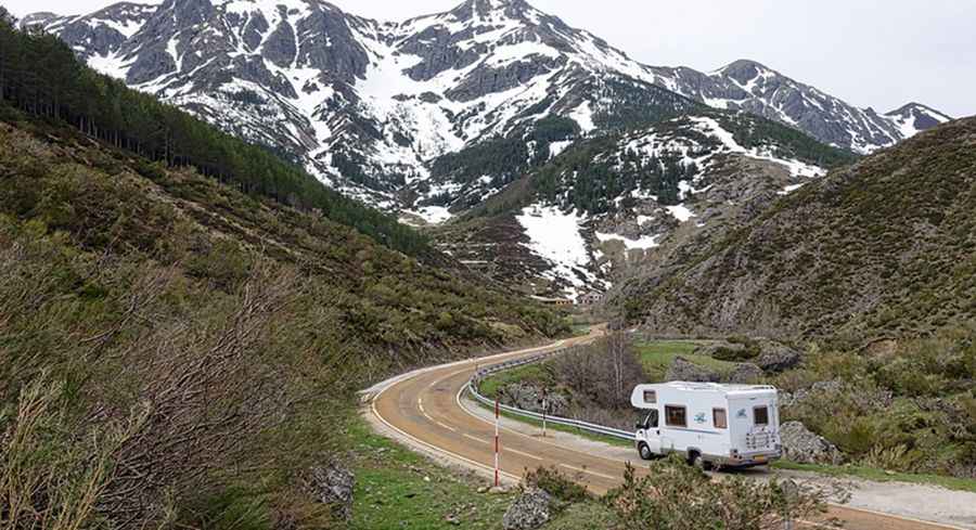
1. Newfound Gap Road (The Central Axis)
The Newfound Gap Road is the only fully paved arterial that bisects the center of the National Park. Ascending 3,000 feet from the Gatlinburg basin, this 31-mile stretch is a masterpiece of mountain engineering. RV drivers must be prepared for continuous climbing through pine and oak woodlands, crossing the Appalachian Trail at the summit. It is the primary route for crossing between Tennessee and North Carolina.
2. Blue Ridge Parkway (The High-Altitude Traverse)
Known as "America's Favorite Drive," the Blue Ridge Parkway is a 469-mile feat of engineering that reaches 6,053 feet at Richland Balsam. For RVs, it offers wide vistas but requires caution due to frequent tunnels with limited clearance and sustained grades. It is a slow-paced route designed for maximum situational awareness of the surrounding Pisgah National Forest.
3. Cherohala Skyway (The Backcountry Technical)
The Cherohala Skyway is often considered the most scenic and least congested alternative to the main park roads. Climbing to nearly 6,000 feet over 36 miles, it connects North Carolina and Tennessee through the Tellico River Gorge. This route features steep granite walls and sweeping curves that test a vehicle's lateral stability and cooling systems.
4. Clingmans Dome Road (The Vertical Limit)
To reach the highest point in the park, drivers must navigate the 7-mile Clingmans Dome Road. While paved, the road is winding and ends at a high-altitude parking area situated at 6,643 feet. Note that this sector is seasonally closed from December through March due to severe ice and snow accumulation, which can occur even when the lower valleys remain temperate.
5. Cades Cove Loop (The Wildlife Perimeter)
The Cades Cove Loop is an 11-mile, one-way technical circuit. While the speeds are low, the road is narrow and requires constant vigilance for wildlife (black bears, elk, and coyote). It is the premier location for observing the historic 19th-century log homes and churches of the early settlers within a broad mountain-ringed valley.
Logistics and Safety for RV Travelers
When planning your Smoky Mountain expedition, consider these technical factors:
- Braking Systems: Sustained descents on the Newfound Gap can overheat standard brake pads. Use low gears to manage speed.
- Campground Strategy: For high-tonnage RVs, established parks like Foothills, Riveredge, and Smokey Bear offer the best stabilized pads and hookup infrastructure.
- Gatlinburg Congestion: With over 10 million annual visitors, the gateway to the park can be a bottleneck. Timing your entry for early morning is critical for large vehicles.
Whether you are visiting for the thrill of the climb or the American heritage of Dollywood, an RV trip through the Great Smoky Mountains remains the definitive way to experience the Appalachian range. Respect the gradients, monitor the weather, and enjoy the unique blue-hued horizons of the South.