Butler Peak
Butler Peak is a high mountain peak at an elevation of 2.570m (8,431ft) above the sea level, located in San Bernardino County, California, United States. A vehicle with decent ground clearance and good tires shouldn’t have an issue.
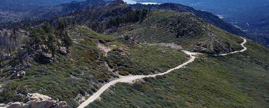
The road to the summit, located in the San Bernardino Mountains, is gravel, rocky, tippy and bumpy at times. It’s called Forest road 2N13B (Butler Peak Road). The road is usually impassable from October to June (weather permitting). The road has been graded, however it is not suitable for low clearance vehicles. Four-Wheel Drive is highly recommended, but not absolutely necessary. The peak was named after George E. Butler, a local politician and Bear Valley property owner. There are spots where gravel and dirt are very loose and the traction from Two-Wheel Drive may not allow vehicles with light back ends (unloaded pickup trucks) to proceed on the steep grades.
The road to the summit was built in 1948. Great trail for experienced wheelers. 4x4 vehicle recommended. For your safety, be sure to check the weather forecast before you begin your trip. At the summit there’s a lookout tower built in 1931. If there is a thunderstorm in the area, please do not visit a lookout. Expect a trail pretty steep. The summit offers spectacular 360° views including sites such as San Gorgonio Peak, the Big Bear Valley, Lake Arrowhead, Apple Valley, and the Inland Empire.
Pic: Brad Betts