How high is the Red Cliff Bridge in Colorado?
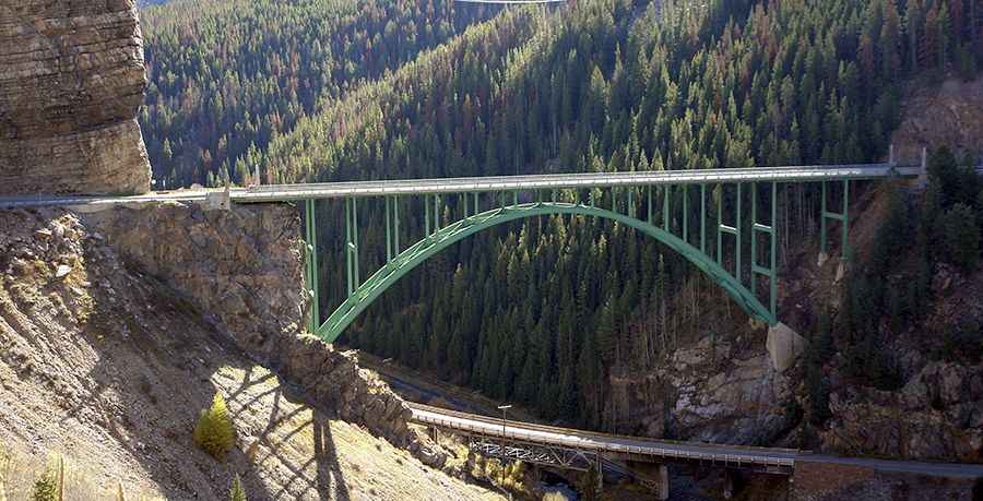
The Red Cliff Bridge (officially known as the Silver Bridge or Eagle River Bridge) is a historic steel arch bridge spanning 143.5 meters (471 ft) in Eagle County, Colorado, USA. Carrying US Highway 24 over the Eagle River and Union Pacific railroad tracks, the bridge hangs 62 meters (204 ft) above the canyon floor near the town of Red Cliff. It's one of the most spectacular bridges in the world.
| Road facts: Red Cliff Bridge (Silver Bridge) | |
|---|---|
| Location | Eagle County, Colorado (USA) |
| Route Designation | US Highway 24 |
| Total Length | 143.5 m (471 ft) |
| Height Above Canyon | 62 m (204 ft) |
| Structure Type | Open-spandrel steel arch bridge |
| Build Date / Restoration | Built 1940 (Opened 1941) / Restored Nov 2004 ($3.6M) |
| Elevation | 2,630 m (8,630 ft) above sea level |
| Surface | Paved asphalt two-lane deck |
Where is the Red Cliff Bridge located?
The bridge sits on US Highway 24 in the Rocky Mountains of central Colorado, about half a mile southwest of the historic mining town of Red Cliff. It spans a steep, narrow canyon between Minturn and Leadville at an altitude of 2,630 meters.
What type of structure carries US Highway 24?
Erected in 1940 and opened in 1941, it is an open-spandrel steel arch bridge and one of only two arch bridges of its kind in Colorado. Listed on the National Register of Historic Places, the deck rests on green-painted steel arches anchored directly into the granite canyon walls. The state completed a $3.6 million structural restoration in November 2004 to replace the concrete deck and reinforce the steel framing.
Where can you view the Red Cliff Bridge?
Drivers can pull over at a paved scenic viewpoint located just north of the bridge along US 24, or use the turnout at the north end of the span on the Red Cliff access road to view the 204-foot drop into the gorge.
What are the driving hazards on the Red Cliff Bridge?
Set high in the Rockies, the paved bridge deck freezes quickly in winter, creating sudden black ice patches before the surrounding road surfaces freeze. Heavy crosswinds sweep through the gorge, while snow accumulation and narrow shoulders leave zero room for error along the concrete side barriers.
Road suggested by: Rexford Haugen
Pic: www.codot.gov