Road to Eightmile Mesa: Driving the 2,494m USFS #651 in Colorado
Located in Archuleta County, Colorado, Eightmile Mesa is a high mountain peak at an elevation of 2,494m (8,182ft) above sea level. Situated within the San Juan National Forest, the summit is accessed via the Eight Mile Mesa Rd (USFS Road #651), a technical unpaved track that provides logistical access to a high-altitude fire lookout tower built in 1963.
| Road facts: Eightmile Mesa (USFS #651) | |
|---|---|
| Location | Archuleta County, Colorado (USA) |
| Length | 8.5 km (5.28 miles) from US-84 |
| Elevation Gain | 314 m |
| Average Gradient | 3.69% |
| Surface | Unpaved (Dirt, Sand, and Rock) |
How is the road to Eightmile Mesa summit?
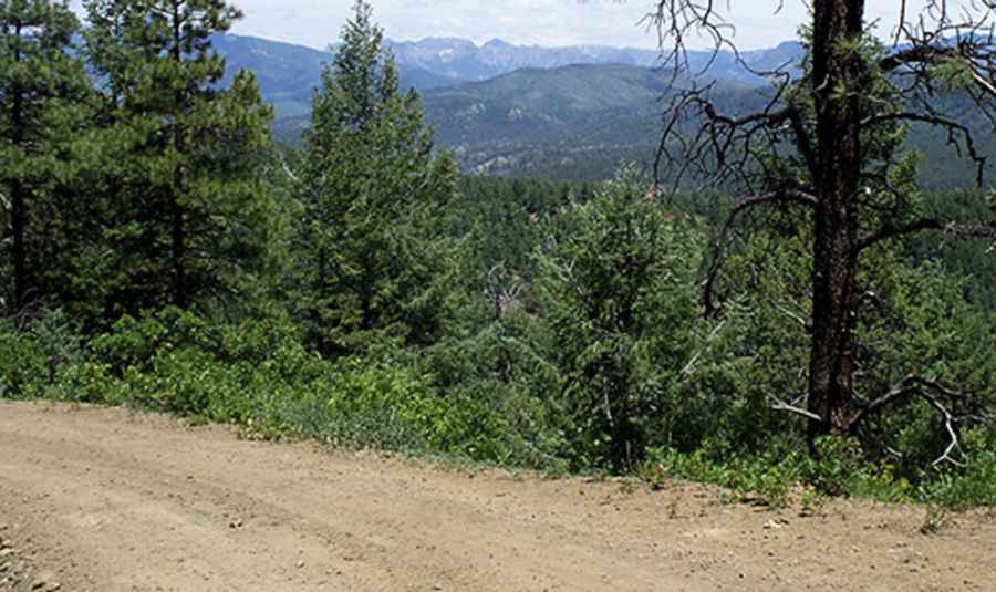
The climb to the Eightmile Mesa summit begins at the junction with the paved US-84. The total distance is 8.5 km (5.28 miles) with a steady elevation gain of 314 meters. The first sector of the USFS #651 is lightly graded and manageable for most vehicles. However, after the fork with road 651A, the terrain becomes more technical. The track transitions into a rutted road with sandy pockets, dips, and rocky outcrops. While the average gradient is 3.69%, the mechanical challenge lies in the surface irregularities rather than the steepness. In several sections, the track is only one vehicle wide, requiring drivers to identify passing points in advance.
What are the hazards of driving the USFS #651 track?
The primary hazards on Eightmile Mesa Rd are the lack of drainage and the changing nature of the soil. The sandy and silty sections become impassable mud traps immediately after rainfall. High-clearance vehicles are strongly recommended to navigate the deep ruts and rocky dips without damaging the undercarriage. Logistically, the road is unmaintained during winter and is typically blocked by snow from October until June. Another critical safety factor is the lightning risk at the summit; as a high point with a metal lookout tower, the area must be evacuated immediately if a thunderstorm is detected in the San Juan Mountains region.
Vehicle requirements for Eightmile Mesa logistics
In dry conditions, a 2WD vehicle with reasonable clearance can reach the lookout, but a 4x4 is mandatory if there is any moisture on the ground. The sandy sectors can easily cause a 2WD vehicle to lose traction. For vehicles with low ground clearance, the rocky "dips" in the second half of the route pose a high risk of oil pan or exhaust damage. Before starting the 8.5 km transit, check the mechanical integrity of your suspension. Ensure you have a full-size spare, as the sharp rocks on the upper mesa can cause punctures in standard passenger tires. There are no services or water supplies along the USFS #651.
Operating the Eightmile Mesa fire lookout area
The summit of Eightmile Mesa is dominated by the 1963 lookout tower, which remains an active emergency facility for the San Juan National Forest. Logistically, the area around the tower is restricted during active fire monitoring or emergencies. When driving near the summit, maintain a low speed to minimize dust, which can interfere with visibility from the tower. The final approach requires careful gear selection to manage the uneven surface. From a logistical standpoint, the mesa provides a clear line-of-sight to Pagosa Springs, but mobile signal can be intermittent depending on your exact position relative to the mountain ridges.
Pic&more info: http://pagosasprings.com/the-charm-of-eightmile-mesa-in-southeast-pagosa-country/