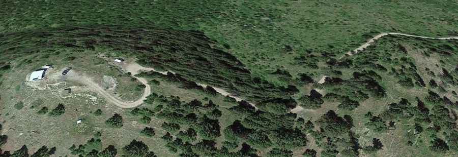
Union Peak: Driving the Rocky Garnet Range Road in Montana
Union Peak is a mountain summit at an elevation of 2,073 meters (6,801 ft) above sea level, located in Granite County, Montana. Tucked deep within the rugged Garnet Range, the route to the historic 1963 lookout tower is the Garnet Range Road. It is an unmaintained, unpaved single-lane forest track packed with loose rock shards, deep ruts, and sharp drop-offs with zero side protections.
| Road facts: Union Peak (Garnet Range Road) | |
|---|---|
| Location | Granite County, Montana, USA |
| Elevation | 2,073 m (6,801 ft) |
| Length | 15.4 km (9.5 miles) from MT-200 |
| Average Gradient | 5.25% |
| Surface | Unpaved loose gravel, dirt ruts, and jagged stones |
How rough is the 15.4-km climb on the Garnet Range Road?
The unpaved mountain route begins at the turn-off with the paved MT-200 highway. From the valley, the track climbs 810 vertical meters over a 15.4-kilometer run to the lookout. The average slope is 5.25%, but the ground is notoriously broken, uneven, and bumpy. Severe water erosion has cut deep dirt ruts that tip vehicles sideways. The surface consists of a loose layer of gravel and jagged mountain stones that rub against tire sidewalls and break tire traction on the narrowest parts of the ridge line, forcing drivers to pick lines carefully to avoid striking the oil pan.
Why is the Garnet Range Road closed for most of the year?
Due to the high altitude in western Montana, the entire mountain pass is buried under thick snowbanks from October until late June, making the track completely impassable for standard wheeled vehicles. During the short summer driving window, sudden mountain storms turn the clay-heavy forest soil into a slick mud slurry that packs tire treads and eliminates all lateral grip on the slopes. Because this is a remote forest service route, maintenance is non-existent; spring thaws regularly trigger rockslides and bring down heavy pine trees directly onto the driving lane, forcing drivers to manually clear obstacles or turn back on narrow ledges.
What infrastructure and terrain dangers exist on the Union Peak track?
The upper sections of the track shrink down to a tight single-lane shelf road cut into the mountainside with zero steel guardrails or side walls. The road lacks passing bays; meeting an oncoming truck forces one driver to execute a difficult reverse maneuver on a bumpy, unpaved ledge right next to steep valley drops. On the long 15.4-kilometer descent back to the MT-200 junction, the continuous down-slopes put a heavy load on vehicle brakes. Relying entirely on the foot brake will overheat the pads and cause brake fade. Drivers must lock the transmission into low gear to use engine braking to hold the truck weight down the rocky ramps.