Dog Mountain: Driving the NF-406 road to the 6,929ft lookout in Oregon
Rising to an elevation of 2,112m (6,929ft) above sea level, Dog Mountain is a prominent peak located in Lake County, Oregon. Situated within the vast Fremont-Winema National Forest, the summit is home to an active fire lookout tower, offering expansive views over the rugged, high-desert landscape of Southern Oregon, just a few miles from the California border.
| Road facts: Dog Mountain (Lake County) | |
|---|---|
| Location | Lake County, Oregon, USA |
| Elevation | 2,112 m (6,929 ft) |
| Road Number | NF-406 (Forest Road 406) |
| Length | 5.3 miles (8.5 km) |
| Avg Gradient | 5.27% |
Where is Dog Mountain located?
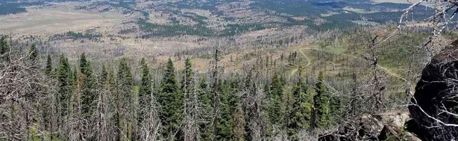
The peak is situated in the southern part of Oregon, south of Quartz Mountain. It lies within the Fremont National Forest section of the combined management area. The geography here is characterized by high-altitude plateaus, dense pine forests, and massive volcanic rimrocks. This is a remote corner of the state where the roads are primarily used for forest management and fire suppression, far from the crowded hiking trails of the northern Cascades.
What is at the summit of Dog Mountain?
The summit is dominated by a modern fire lookout tower built in 1997. This specific R-6 flat-top design features a cab devoted to fire detection activities, with integrated living quarters on the first floor for the staff. Unlike many abandoned lookouts, this one is in excellent condition and is actively staffed by the Forest Service during the peak fire season. From the observation deck, drivers are rewarded with a 360-degree panorama that includes the Warner Mountains and the vast basins of Southern Oregon.
Is the road to Dog Mountain unpaved?
The road to the summit, designated as NF-406 (Forest Road 406), is totally unpaved and consists of forest dirt and crushed volcanic rock. While it is generally well-maintained for lookout access, the surface can become washboarded and loose during the dry summer months. A 4x4 vehicle is highly recommended due to several steep ramps and the potential for deep ruts after spring runoff. The track is narrow and winds through thick timber before emerging onto the exposed, rocky summit ridge.
How long is the road to Dog Mountain?
Starting from Barnes Valley Road (NF-388), the ascent to the summit is 5.3 miles (8.5 km) long. Over this distance, you will tackle an elevation gain of 1,476 ft. The average gradient is 5.27%, making it a steady climb, though certain switchbacks are considerably steeper. Drivers should stay alert for logging trucks and other Forest Service vehicles that may be using these narrow corridors.
Is the road to Dog Mountain open in winter?
Due to its high elevation of nearly 7,000 feet, the NF-406 road is impassable during the winter. Heavy snowpacks typical of the Oregon high country block access from late October until at least June. Even after the snow melts, the road can be extremely muddy and soft, making it dangerous for heavy vehicles. The best time to visit is during the summer months when the lookout is staffed and the wildflowers are in bloom.
What are the main hazards when driving to the lookout?
The primary hazards on the drive to Dog Mountain are isolation and local wildlife. This is a remote area where mobile phone service is non-existent; a mechanical failure could leave you stranded for a long time. Additionally, the Fremont-Winema forest is home to mule deer, elk, and black bears, which frequently cross the road, especially at dawn and dusk. Always carry a full-size spare tire, extra water, and a paper map of the Forest Service roads to navigate the maze of timber tracks safely.
Pic: Bill Jennings