The unpaved road to South Mount Hawkins in California
South Mount Hawkins is a high mountain peak at an elevation of 2.373m (7,785ft) above sea level, located in Los Angeles County, in the US state of California. The road to the summit is only maintained on a needed basis such as a fire or access to the forest service repeater.
Where is South Mount Hawkins?
The peak is located north of Pasadena, in the southern part of California, within the Angeles National Forests.
Why is it called South Mount Hawkins?
The peak was named for Nellie Hawkins, a waitress during the early years of this century at Squirrel Inn.
Why is there a road to South Mount Hawkins?
Set high in the San Gabriel Mountains, at the summit there was a lookout tower destroyed in the Curve Fire on September 1, 2002.
Is the road to South Mount Hawkins unpaved?
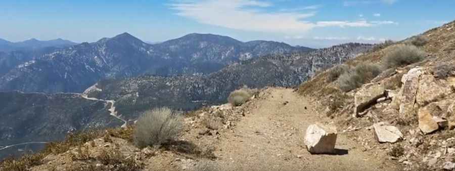
The road to the summit is totally unpaved. It’s called Forest Service Road 3N07. The road is very narrow in some sections and has dangerous drops. 4x4 vehicle required. There are washouts along the way.
How long is the road to South Mount Hawkins?
Starting from Deer Flats Group Campground, the road to the summit is 7 km long. Over this distance, the elevation gain is 417 m and the average gradient is 5.95%.
Can I drive to South Mount Hawkins?
Hikers and bicycle riders can still clear the track to the top of South Mount Hawkins, though the path is currently strewn with rocks, boulders, and active washouts. The Forest Service has abandoned regular upkeep on this dirt road, which runs from the Deer Flats Group Campground up to the old concrete fire watch tower platform. Maintenance on the alignment is now restricted to an as-needed basis, occurring only during active wildfires or to clear access toward the forest service repeater.
Pic&video: E5827