Mount Hopkins
Mount Hopkins is a high mountain peak at an elevation of 2.612m (8,569ft) above the sea level, located in the Santa Rita Range, in Santa Cruz County, southern Arizona, USA.
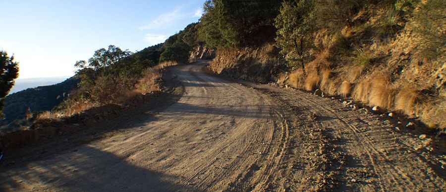
The narrow winding mountain road to the summit is called Mount Hopkins Road. It’s mostly unpaved. Due to the high elevations and exposure, the road is subject to strong winds and rapid weather changes. Be prepared for the cold and wind! High winds blow here all year long. The peak is the home to the Fred Lawrence Whipple Observatory, an astronomical observatory owned and operated by the Smithsonian Astrophysical Observatory. The last three miles are open for guided tours only. Its many twists, turns and narrows can pose a challenge to even the most experienced drivers. The road is not easy, though. Up, down, right, left all the time.
Located within the boundary of the Coronado National Forest, the road is more or less a series of switchbacks. It’s very steep, especially the last part of the climb. The journey offers an exhilarating driving experience, with superb views. Views all along this mountain-climbing route are breathtaking, but because the road is a twisting single lane of dirt without guardrails, the drive will require your full attention. This is definitely one road trip that you want to record with lots of photographs. The road is a 10-mile, single-lane dirt road with few guard rails. Person unaccustomed to mountain roads of this type should consider this trip carefully.
Pic: Galit Morales