How to conquer the defiant Edison Butte OHV Trail in Oregon?
Edison Butte OHV Trail is a very exciting trail with some awesome scenic views, located in Deschutes County, in the US state of Oregon. It’s a rocky trail that involves lava ridges for extra excitement.
Where is the Edison Butte OHV Trail?
The trail is located west of Bend, in the central part of Oregon, within the Deschutes National Forest. Because of the remoteness of the area, be sure to be careful and pack a first aid kit.
How challenging is the Edison Butte OHV Trail?
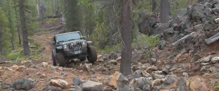
The road is totally unpaved and comprises big rocks. It’s not an easy drive. Large, sharp rocks require tight maneuvering, increasing the likelihood of tire damage. Vehicles exceeding 80 inches in width are not allowed.
How long is the Edison Butte OHV Trail in Oregon?
The trail is about 40km (25 miles) long. A complex network of poorly defined sections makes route-finding very difficult, even when following a GPS tracklog. The volcanic terrain can be challenging for various users because there are many loose rocks and lava ridges.
When is the best time to drive the Edison Butte OHV Trail?
Set high south of Mount Bachelor, this rugged trail is only open from April 1st through November 30th, as snow and ice make it too dangerous during the deep winter. The trail gets extremely dusty in summer and may be closed seasonally or due to fire restrictions.
Pic&video: Jerry Johnson