How to drive the Broken Arrow 4x4 Trail in Sedona?
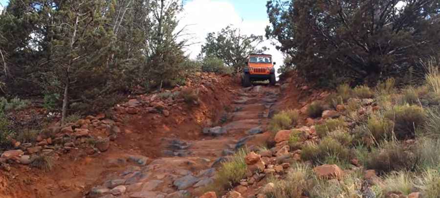
Spanning Coconino and Yavapai counties in the U.S. state of Arizona, Broken Arrow Trail is a famous 4-mile (6.4 km) unpaved off-road track running through the red rock country of the Coconino National Forest. It climbs 300 feet of elevation gain to Chicken Point, serving as one of the most technical short 4x4 routes in Sedona.
| Road facts: Broken Arrow Trail | |
|---|---|
| Location | Coconino and Yavapai Counties, Arizona (USA) |
| Distance | 6.4 km (4 miles) to Chicken Point |
| Elevation Gain | 91 meters (300 feet) |
| Surface | Unpaved red slickrock, loose dirt, rock ledges (100% off-road) |
| Vehicle Requirements | High-clearance 4x4 with low range (4-Low) |
| Key Hazards | Steep rock ledges, severe washboards, narrow single-lane shelves |
Where is the Broken Arrow Trail located?
The trail begins at the end of Morgan Road, just south of downtown Sedona, straddling Coconino and Yavapai counties. It climbs directly through the sandstone rock formations of the Coconino National Forest, ending at the Chicken Point rock formation.
Is the Broken Arrow Trail fully paved?
No, the trail is 100% unpaved. The road surface consists of bare red slickrock, compressed sand, embedded stone shelves, and unpaved dirt tracks. Conditions change rapidly: the track can be smooth rock one day and heavily rutted with severe washboards the next.
What vehicle do you need for Broken Arrow Trail?
Average passenger cars and low-clearance crossovers cannot drive this route. The trail demands an SUV or truck with high ground clearance, skid plates, and a low-range 4WD transfer case (4-Low). While extreme wheel articulation is not mandatory, high clearance is essential to clear large rock ledges without smashing the oil pan or bumpers.
What are the main obstacles on Broken Arrow Trail?
The route features three major technical obstacles along the red rock section:
Submarine Rock: A massive flat slickrock platform where vehicles drive directly along the spine of a giant rock monolith.
The Steps / Devil's Staircase: A steep downhill descent cut into natural rock ledges where low-clearance vehicles easily scrape undercarriages if the driver misjudges the tire line.
The Road of No Return: A one-way, highly inclined rock ramp section where backing up or turning around is physically impossible if traction is lost.
What are the main hazards when driving Broken Arrow Trail?
Severe washboards can bounce vehicles off-line toward steep ledge drops if speed is not controlled. Additionally, steep downhill barriers like "The Measures" intimidate inexperienced drivers, while heavy commercial Pink Jeep tour traffic forces non-local drivers to yield on narrow shelves with zero shoulder clearance.
Why is Broken Arrow Trail famous in Sedona?
Besides its slickrock driving terrain, the area served as a filming location for classic Hollywood Westerns, including the 1950 film "Broken Arrow" starring Jimmy Stewart, which gave the trail its name.
Pic&video: Chris Walden