The road to Wheeler Pass in Nevada is pure adventure
Wheeler Pass is a high mountain pass at an elevation of 2,345m (7,693ft) above sea level, located in Clark County, Nevada. The trail to the summit has rocky and eroded sections on both sides of the pass.
Is the road to Wheeler Pass in Nevada unpaved?
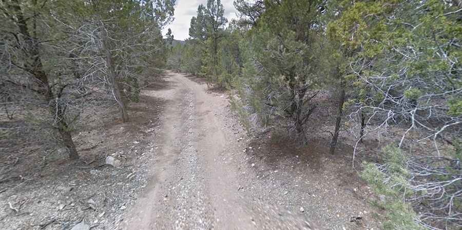
The road to the summit, Wheeler Pass Road, is entirely unpaved. It is rocky, with many large rocks, some with sharp edges. The difficulty increases as you approach the highest point. A high-clearance 4x4 vehicle is strongly recommended. Parts of the trail have been washed out by a creek.
How long is Wheeler Pass in Nevada?
The road, located northwest of Las Vegas, is 62.92km (39.1 miles) long, running east-northwest from Pahrump (on NV-160) to US-95 (Veterans Memorial Highway).
Is Wheeler Pass in Nevada open?
Located in the Spring Mountains, within the Spring Mountain National Recreation Area, the road is typically impassable from October to June due to snow, weather permitting.
How challenging is the road to Wheeler Pass in Nevada?
In some sections, the trail is so narrow that nearly any vehicle might get scratched by bushes or trees. The stretch from Pahrump to the top of the pass is relatively easy and any 4x4 should manage. However, the section from Cold Creek to the top (from the Vegas side) presents more of a challenge. Cellular service is nearly non-existent throughout the route. Some sections have ruts and rocks, but under good conditions, they should not pose significant obstacles.
Is the road to Wheeler Pass in Nevada worth visiting?
From the top of the pass, you can see for miles in every direction, offering views of the nearby mountain ranges and valleys. You might encounter wild horses on the road and in surrounding areas. The route passes several points of interest, including the Charcoal Kilns constructed in 1877. In the 1800s, Wheeler Pass served as the primary route connecting the Pahrump Valley to the Indian Springs area. East of the summit, a minor gravel road ascends to 2,501m (8,205ft) above sea level.