A Rough and Rocky Road to Calispell Peak in Washington
Calispell Peak is a high mountain peak at an elevation of 2,090m (6,856ft) above sea level, located in Stevens County, in the U.S. state of Washington. It’s one of the highest roads in Washington.
Why Is It Called Calispell Peak?
Tucked away in the northeastern part of Washington, the peak was named to honor the Kalispel Indians, a sub-tribe of the Pend Oreille Indians, who historically inhabited the region.
What’s at the Summit of Calispell Peak?
Several communications facilities and radio towers are built at the summit. Being the highest point for over 33 miles, it has been an ideal location for fire lookouts and communications facilities. In 1920, a fire lookout camp was established at the summit, followed by the construction of a 10' x 10' cab in 1921. In 1936, a 40-foot-tall L-4 fire tower was built, remaining in place until it was dismantled in 1955. In later years, several communications facilities were installed at the summit due to its advantageous elevation. The summit offers amazing 360-degree views above the treeline in an alpine meadow. The area contains a beryllium mine.
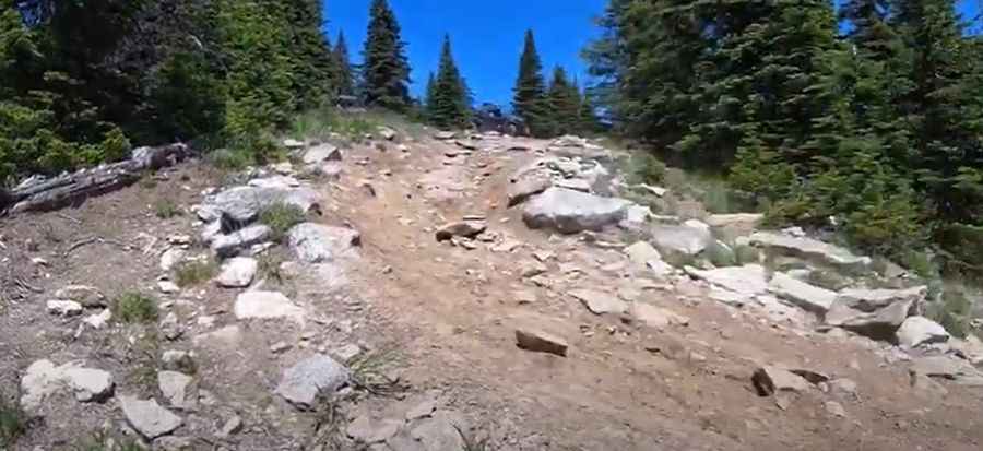
Is the Road to Calispell Peak Unpaved?
The unmaintained road to the summit is completely unpaved, very rough, rugged, and rocky. It’s called NF-629 (Calispell Peak Road). Road conditions will vary depending on the season, recent rains, and road grading. But plan for a road that is slow-going, rocky, and potentially rutted.
How Long Is the Road to Calispell Peak?
The road to the summit is pretty steep. Starting from Highway 2389 (Tacoma Creek Road), the ascent is 14.16km (8.8 miles) long. Over this distance, the elevation gain is 1,282 meters. The average gradient is 9.05%, hitting a 12.5% of maximum gradient through some of the ramps.
Can I Drive My Vehicle to Calispell Peak?
The road is very rough in places and a high-clearance 4WD vehicle is required to complete the drive to the summit.
Is the Road to Calispell Peak Open in Winter?
It is usually impassable to vehicles from October to June (weather permitting). When snow is present, the road is a good option for snowshoeing or skiing. The peak is famous for the wind that sometimes whips across the top. With wet and muddy conditions, the road might be impassable.
Pic&video: Merrill Ott