How to drive the unpaved road to Wenatchee Mountain in Washington?
Wenatchee Mountain is a high mountain peak at an elevation of 2.059m (6,755ft) above sea level, located in Chelan County, in the US state of Washington. It’s one of the highest roads of Washington.
Where is Wenatchee Mountain?
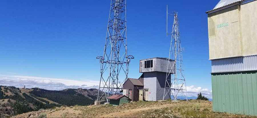
The peak is located above the Mission Ridge Ski Resort in the central part of Washington, within the Wenatchee National Forest. Near the summit there’s a lookout site.
Is the road to Wenatchee Mountain unpaved?
The rough road to the summit is totally unpaved. It’s called Naneum Ridge Road. It’s a narrow single-track trail with hard-pack dirt and rock and very rocky near the top. AWD and some clearance highly recommended. The west ridge road is absolutely terrible. Recommend taking east ridge.
How long is the road to Wenatchee Mountain?
Starting from Colockum Road, the road to the summit is 15.5 km long. Over this distance, the elevation gain is 585 m and the average gradient is 3.77%.
Is the road to Wenatchee Mountain open year-round?
The road is totally impassable in winters. The peak is famous for the wind that sometimes whips across the top. Road conditions will vary depending on the season and recent rains and road grading. But, plan for road that is slow going, rocky and potentially rutted. If you plan to go in the spring, be aware that the road may still be covered in snow and may not be passable.
Pic: Ron Reiman