Ultimate 4wd destination: Logan Peak in Utah
Logan Peak is a high mountain peak at an elevation of 2.964m (9,724ft) above sea level, located in Cache County, in the US state of Utah.
Where is Logan Peak?
The peak, commonly referred to as Mount Logan, is located in the northern edge of Utah, within the Uinta-Wasatch-Cache National Forest.
Is the road to Logan Peak unpaved?
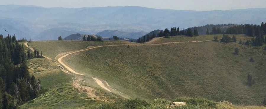
The road to the summit is totally unpaved. It’s called Forest Road 042 (Logan Peak Road). It’s newly constructed.
How long is the road to Logan Peak?
Starting from Forest Road 168, the ascent is 4.02km (2.5 miles) long. The road is pretty steep. Over this distance the elevation gain is 257 meters and the average gradient is 6.39%.
How challenging is the road to Logan Peak?
Some parts of the road are very narrow with dangerous drop-offs. It has a couple of switchbacks in it as it reaches the peak, which makes the grade of the road very gradual. 4x4 vehicle required.
Is the road to Logan Peak open in winter?
Set high in the Bear River Range, the road is not maintained in winter. It is not generally snow-free until late June or even July in some years. The winds up are also very strong and make the stay at the top uncomfortable at times, but the views make it worth it. Temperatures here in the winter are brutally cold.
What’s on the summit of Logan Peak?
The summit hosts a telecommunications tower and a small building that has some weather instruments and other things associated with it. Dependent on the air clarity, you may even be able to see Wyoming’s Tetons in the distance.
Pic: Nathan Guymon