Travel guide to the top of Storm Mountain in Colorado
Storm Mountain is a high mountain peak at an elevation of 3,006m (9,862ft) above sea level, located in Larimer County, in the U.S. state of Colorado.
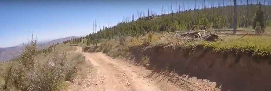
Is the road to Storm Mountain in Colorado unpaved?
The road to the summit is entirely unpaved. It’s called Storm Mountain Road or Cedar Park Road. The first part of the drive has some tight curves - just take it slow. The trail is narrow with few places for passing, so meeting someone can be a challenge. To drive up this road, you need a 4x4 vehicle. Exercise extreme caution with fallen trees across the path.
How long is the road to Storm Mountain in Colorado?
Starting from US Highway 34 near Drake, in the Big Thompson Canyon, at 1,894m (6,213ft) above sea level, the road is 21.08km (13.1 miles) long. Over this distance, the elevation gain is 1,112 meters. The average gradient is 5.27%.
Is the road to Storm Mountain in Colorado open in winters?
Set high in the Arapaho & Roosevelt National Forests, the road is open seasonally, usually from mid-June to December 1st.
Is the road to Storm Mountain in Colorado worth it?
The journey offers the chance to see wildlife. Keep an eye out for deer, elk, moose, and bears, as all are abundant. Once at the top, you are treated to an unobstructed view of cities in the front range valley and Estes Park.
Pic&video: J Tim Norris