How to Get by Car to Swamp Lake in California
Swamp Lake is a high mountain lake at an elevation of 2,929m (9,609ft) above sea level, located in Fresno County, in the US state of California. Damage is possible even for the most capable vehicle. It's one of the highest roads in California.
Where is Swamp Lake?
The lake is located in the central part of California, within the Sierra National Forest.
How challenging is the trail to Swamp Lake?
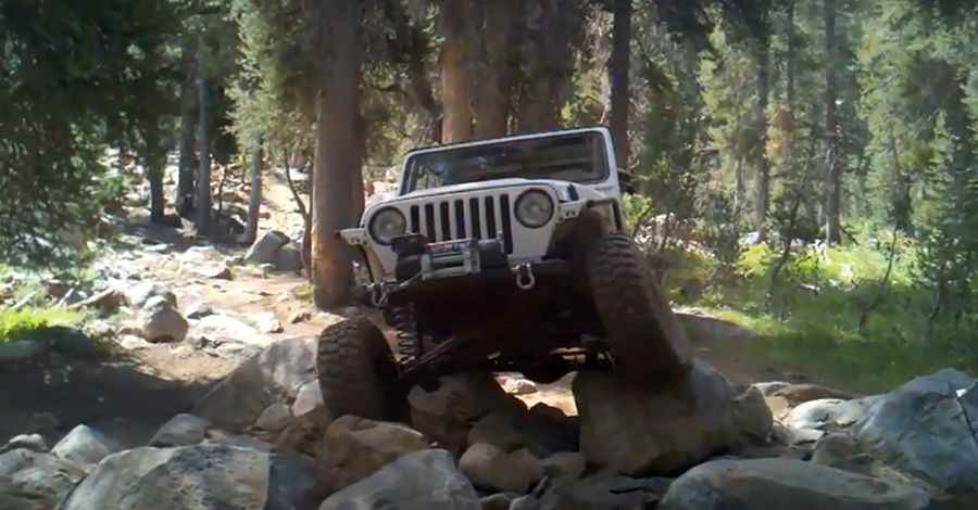
The road to the summit is totally unpaved, very steep, with large boulders and very defiant. One mistake can have serious consequences. Road conditions are always changing, with large, challenging boulders and steep, hair-raising climbs. It can be muddy in places. From Highway 168 in Shaver Lake, take Dinkey Creek Road east 11.8 miles and turn right on McKinley Grove Road just before Dinkey Creek. Go 2.3 miles and turn left on Big Fir Road 10S13 at sign for Swamp Lake and Hatch Lake. Go another 3.0 miles and turn left at wide intersection on 10S66. Bear left again after another 1.2 miles on 10S31. You'll see gate for 'Swamp Route' on right in another 0.8 miles. The route is a low standard logging road for the first mile, and then deteriorates into a four wheel drive road as it climbs higher up the mountain.
Can I drive my vehicle to Swamp Lake?
The trail is definitely not for stock SUVs. Modified vehicles need very high ground clearance. Recommend at least one differential locker.
Is the road to Swamp Lake open in winter?
Set high in the High Sierra Mountains, the road is usually impassable in winters.
Is the road to Swamp Lake worth the drive?
Along the way to the lake, there are many excellent fishing lakes, although some require short hikes. The scenery is very impressive from high vistas along the route. Panoramic views of the surrounding lakes, meadows, and peaks can be seen. Even during holiday weekends, the remote location ensures that the number of other drivers is minimal.
Pic&video: GST95DSM