A Rough 4x4 Road to Sundance Mountain in Idaho
Sundance Mountain is a high mountain peak at an elevation of 1,914m (6,279ft) above sea level, located in Bonner County, in the U.S. state of Idaho. The summit is accessible by high-clearance 4x4 vehicles during the summer. It was the site of a devastating wildfire caused by lightning in August 1967, which claimed two lives.
Where is Sundance Mountain?
The peak is located in the northern part of Idaho, near the border with Washington State, within the Idaho Panhandle National Forest.
Why is Sundance Mountain Famous?
In the late summer of 1967, a forest fire erupted on Sundance Mountain and consumed approximately 56,000 acres on the mountain and surrounding areas. The mountain is still recovering from the fire, which burned away its trees and left behind a forest of ghostly, fire-scorched snags covering its slopes. At the time, the Sundance fire was considered the most destructive in Idaho in 50 years.
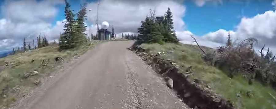
How Challenging is the Road to Sundance Mountain?
The road to the summit is completely unpaved and presents significant challenges. One mistake can have serious consequences. The road is minimally maintained, requiring drivers to navigate obstacles like fallen trees, brush, and other hazards. The last quarter of the route is steep and rocky, unsuitable for most cars without 4-wheel drive and high ground clearance. The road is typically impassable in winter due to snow.
How Long is the Road to Sundance Mountain?
The road to the summit is very steep. Starting from the paved Cavanaugh Bay Road in Coolin, the ascent is 12.71 km (7.9 miles) long. Over this distance, the elevation gain is 1,137 meters. The average gradient is 8.94%.
Is the Road to Sundance Mountain Worth the Drive?
The drive offers spectacular views of Priest Lake and the surrounding mountains. This is one road trip you’ll want to document with plenty of photos. At the summit, there is a fire lookout tower built in 1935. Don't be surprised if you spot deer or even a moose in the forest leading up to the mountain.
Pic&video: Tom70s