How to drive the 8 hairpins of Columbus Basin Road in Colorado?
Lewis Mountain is a high mountain peak located in La Plata County, Colorado. While the summit sits higher, a technical gravel road situated north of the peak climbs to an elevation of 3,573m (11,722ft) above sea level. This route, known as Columbus Basin Road, is a demanding high-altitude track within the San Juan National Forest that requires specialized 4x4 equipment.
| Road facts: Columbus Basin Road (Lewis Mountain) | |
|---|---|
| Location | La Plata County, Colorado (USA) |
| Max Road Elevation | 3,573 m (11,722 ft) |
| Length | 3.1 km (1.9 miles) from CR 124 |
| Average Gradient | 11.54% |
| Technical Features | 8 hairpins / High-altitude shelf road |
Where is Lewis Mountain?
The peak is located northwest of Durango in the southwestern part of Colorado, within the San Juan National Forest. Situated south of Snowstorm Peak, the Columbus Basin Road serves as the primary technical corridor through the La Plata Range. Driving in this sector requires navigating old mining trails that offer extreme exposure and high-alpine vistas.
Is the road to Lewis Mountain unpaved?
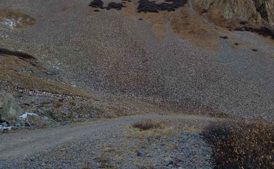
Yes, the Columbus Basin Road leading towards the northern slopes of the mountain is entirely unpaved. Technically, it is a rugged 4x4 track that demands a high-clearance vehicle and low-range gearing. The steep drive requires specific skill and a high tolerance for vertigo, as it is a classic Colorado shelf road. Logistically, drivers must stay alert for potential turnouts, as meeting traffic in narrow, inconvenient locations is a common hazard on this 3.1 km transit.
How long is the road to Lewis Mountain?
Starting from County Road 124 (La Plata Canyon), the road climbs for 3.1 km (1.9 miles). Over this short distance, the elevation gain is 358 meters, resulting in a brutal average gradient of 11.54%. Technically, the track features 8 sharp hairpin turns that test the vehicle's turning radius and traction on loose alpine scree before reaching the 3,573m mark north of the summit.
Is the road to Lewis Mountain open in winter?
No. Set high in the La Plata Range, road conditions are subject to rapid change. Winter arrives early and stays late in the San Juan National Forest; technically, the road is impassable from October to late June. Logistically, it is only recommended to run this trail in the middle of summer when the roadbed is free of snow and stable enough for high-torque maneuvers.
What are the mechanical requirements for the 11.54% descent?
The 3.1 km descent back to CR 124 puts a significant thermal load on the braking system. Technically, the use of engine braking is mandatory to manage speed on the 11.54% average slope. Drivers should monitor tire integrity, as the sharp rocks of the Columbus Basin can easily cause punctures. Given the 3,573m altitude at the high point, ensuring the cooling system is efficient is a logistical necessity to prevent overheating during the slow, technical climb.
Pic: Michael Perez