Road trip guide: Conquering Pilot Peak in ID
Pilot Peak is a high mountain peak at an elevation of 2.476m (8,123ft) above the sea level, located in Boise County, in the U.S. state of Idaho. The top is adorned with a building, solar panels, and a bunch of communication gear.
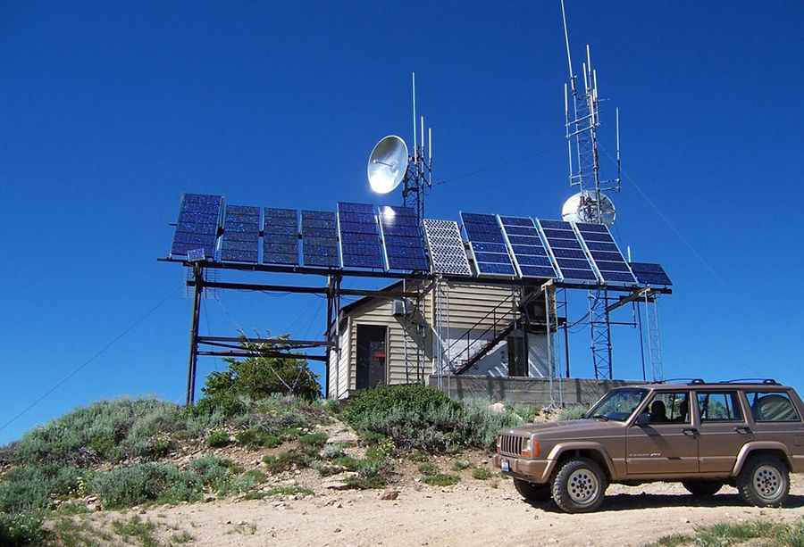
Set high in the Boise National Forest, in southwest Idaho, the road to the summit is totally unpaved. It’s called Forest Road 380 (Summit Flat Road). The road has a few rough places, so a high clearance vehicle is required. There is a former lookout site on the summit which has now been converted to a radio communications area.
Located in the northwestern corner of Boise Range, this road is usually closed from late October through late June or early July (depending on snow). It is not generally snow-free until late June or even July in some years. The road to the summit is very steep, hitting a 14% of maximum gradient through some of the ramps. Starting at Mores Creek Summit, the ascent is 6.59km (4.1 miles) long. Over this distance the elevation gain is 605 meters. The average gradient is 9.18%.
Pic: barkerid