Guthrie Peak
Guthrie Peak is a high mountain peak at an elevation of 2.005m (6,578ft) above the sea level, located in Greenlee County, in the southeastern part of the U.S. state of Arizona.
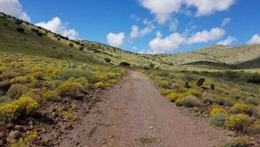
The road to the summit is gravel. High clearance 4WD vehicles required. Portions of the road have narrow drop-offs or are confined by steep cliffs. The weather on this zone is harsh and highly unpredictable. Arizona weather can change quickly. Be prepared. Dress in layers, wear a hat, and pack sunscreen. Always carry plenty of water. Please take extra care to drive defensively on this route. Always expect a vehicle around the next bend and remember: mountain courtesy gives uphill traffic the right of way. Summer months may be really hot. The best time to go is October-May. The summit is the highest point of the Black Hills, the northern extension of the Peloncillo Mountains in eastern Arizona. At the summit there are some communications towers.
Pic&more info: http://www.surgent.net/highpoints/az/range/guthrie.html