How to get to the lookout at the summit of Devil Peak in Mariposa County?
Devil Peak is a high mountain peak at an elevation of 2.128m (6,981ft) above sea level, located in southern Mariposa County, in the US state of California.
Where is Devil Peak?
The peak, also known as Signal Peak, is located near Fish Camp, in the central part of California, in the southernmost part of Yosemite National Park.
What’s at the summit of Devil Peak?
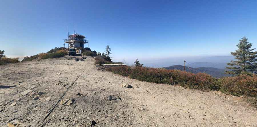
At the summit there’s a lookout tower called Signal Peak Lookout, one of the last remaining active fire lookout towers. The first structure was built in 1900 as a compass lookout, originally serving as a key point for early fire detection. Over the years it has been rebuilt several times, with the current version completed in 1951, and it continues to be staffed for monitoring wildfires.
How long is the road to Devil Peak?
The road to the summit is totally unpaved. Getting to the top is very rocky, but the road is wide. A high-clearance vehicle is necessary to reach the summit. Starting from Tenmile Grade Road, the road to the summit is 3.21km (2.0 miles) long. Over this distance, the elevation gain is 213m and the average gradient is 6.63%.
Is the road to Devil Peak open in winter?
Set high in the Sierra National Forest, the road is usually impassable in winters.
Pic: Alpine Escape Yosemite Rental