How long is the Monitor-Merrimac Memorial Bridge-Tunnel in Virginia?
The Monitor-Merrimac Memorial Bridge-Tunnel (MMMBT) is a 7.4-kilometer (4.6-mile) four-lane bridge-tunnel crossing the James River at the mouth of Hampton Roads in Virginia, USA. Carrying Interstate 664 (I-664), the facility links Newport News on the Virginia Peninsula with Suffolk on the South Hampton Roads mainland. It's one of the most spectacular bridges in the world.
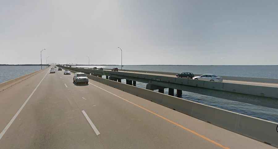
| Road facts: Monitor-Merrimac Memorial Bridge-Tunnel | |
|---|---|
| Location | Hampton Roads / James River, Virginia (USA) |
| Route Designation | Interstate 664 (I-664) |
| Total Length | 7.4 km (4.6 miles) shore-to-shore |
| Tunnel Length | 1,455 m (4,776 ft / 0.9 miles) underwater segment |
| Structure Type | Low-slung concrete trestles, two artificial islands, and immersed tube tunnel |
| Opening Date | April 30, 1992 |
| Toll Facility | Toll-free crossing |
| Key Hazards | Gale-force crosswinds on trestles, tunnel gridlock, sudden rain flooding at portal ramps |
Where is the Monitor-Merrimac Memorial Bridge-Tunnel located?
The bridge-tunnel spans the broad estuary of the James River in southeastern Virginia. Carrying four lanes of I-664, it serves as a western bypass around the core of Hampton Roads, connecting the Peninsula cities with the Southside region.
How is the Monitor-Merrimac Bridge-Tunnel structured?
Opened on April 30, 1992, the 4.6-mile crossing consists of 3.7 miles of low-slung concrete trestle bridges and elevated ramps leading onto two man-made portal islands. Between the islands, traffic dives into a 1,455-meter (4,776-foot) four-lane immersed tube tunnel buried beneath the main shipping channel of the James River.
Why was the bridge named Monitor-Merrimac?
The crossing is named after the historic Civil War Battle of Hampton Roads fought on March 8-9, 1862, directly over the water where the bridge-tunnel now stands. It marks the site of the world's first battle between ironclad warships: the USS Monitor and the CSS Virginia (built on the hull of the USS Merrimack).
Why does I-664 plunge underwater into a tunnel?
The tunnel section keeps the surface shipping channel clear for military vessels operating out of Norfolk Naval Station and commercial cargo traffic serving the Port of Virginia. Constructing a high-level fixed bridge would have created a permanent navigation hazard for aircraft carriers and cargo ships entering the river.
What are the hazards on the Monitor-Merrimac Bridge-Tunnel?
Strong coastal wind gusts sweep across the open trestles during Atlantic storms, leading to high-profile vehicle restrictions. Heavy downpours trigger water pooling on the steep portal approaches plunging into the tunnel, while sudden traffic bottlenecks inside the twin tubes cause frequent rear-end collisions during peak rush hours.
Road suggested by: Brianna Shari