Travel guide to the top of La Sal Pass in Utah
La Sal Pass is a high mountain pass at an elevation of 3,093m (10,147ft) above sea level, located in San Juan County, in the US state of Utah.
Where is La Sal Pass?
The pass is located in the southeastern part of Utah, within the Manti-La Sal National Forest. The road through the summit follows a mountain pass between some of the most prominent peaks in the La Sal Mountains.
Is La Sal Pass unpaved?
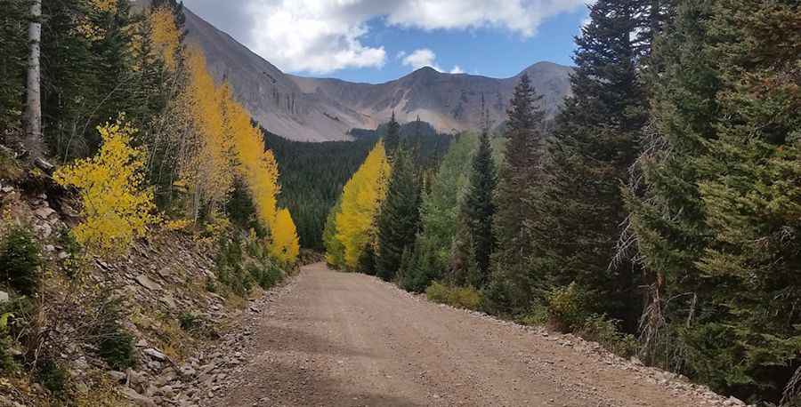
The road to the summit is totally unpaved. It’s called Forest Road 0073 (La Sal Pass Road). The road is 30.89km (19.2 miles) long, running from Geyser Pass Road to Forest Road 0208. It's the highest point on the road. The higher you go, the rougher the trail will become.
Is La Sal Pass open in winter?
Set high in the southeast of the La Sal Mountains, the road is closed through the winter until conditions improve in the spring (weather permitting). It can be impassable at times of high water flows. For current conditions in the La Sal Mountains, contact the Manti-La Sal National Forest District at (435) 259-7155.
How challenging is La Sal Pass?
It’s a great trail for experienced wheelers. This trail is suitable for stock high-clearance vehicles as long as conditions are fair when dry, but it is steep, rocky, and narrow in places on the west side. There is a creek crossing on the east side that most higher clearance, passenger cars can make when it is at lower flows. A minor gravel road west of the pass, called Forest Road 0237, climbs up to 3,140m (10,301ft) above sea level.
Pic: Cecil Tuley