How to Get by Car to Trail Peak in Idaho?
Trail Peak is a high mountain peak at an elevation of 3,147m (10,324ft) above sea level, located in Lemhi County, in the US state of Idaho. It is one of the highest roads in Idaho.
Where is Trail Peak?
The peak is located east of Big Windy Peak, in the eastern part of Idaho.
What’s at the Summit of Trail Peak?
The area was the site of several mines that were active from the 1880s through the 1920s. These mines produced small amounts of gold, moderate amounts of silver, and larger amounts of copper and lead.
Is the Road to Trail Peak Unpaved?
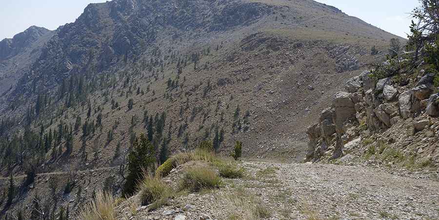
The road to the summit is an old mining road built by miners. It's called Spring Mountain Road. It is totally unpaved and very rough. The road has a few hundred yards of good surface but is mostly rocky. It has no regular maintenance. There are no guardrails and lots of exposure to steep slopes on this drive. There is no cell phone coverage, and a tow will cost you a fortune. Careless driving could be lethal.
How Long is the Road to Trail Peak?
Starting from Hahn, the road to the summit is 12.55 km (7.8 miles) long. Over this distance, the elevation gain is 1,085m (3,560 ft), and the average gradient is 8.64%. To drive this road, you’ll need a true 4WD, all-terrain tires with multi-ply sidewalls, and skid plates. The trail follows numerous remnants of Idaho’s mining heritage.
Is the Road to Trail Peak Open in Winter?
Set high in the Lemhi Mountains, the road is totally impassable in winters.
Pic&more info: http://larryprescott.blogspot.com/2015/08/climbing-sheep-mountain-big-windy-peak.html