Travel guide to the top of Trinity Mountain in Idaho
Trinity Mountain is a high mountain peak at an elevation of 2.868m (9,409ft) above sea level, located in Elmore County, in the U.S. state of Idaho. The road may be blocked by snow until early July. It’s one of the highest roads in Idaho.
Where is Trinity Mountain?
The peak is located in the southwestern part of Idaho, within the Boise National Forest. The summit hosts a fire lookout tower. It is still considered active and utilized during fire season. If there is a thunderstorm in the area, please do not visit the lookout. The view from the top of Trinity Mountain is exceptional, with panoramic views of several subalpine lakes and other mountains in the Boise Range.
How long is the road to Trinity Mountain?
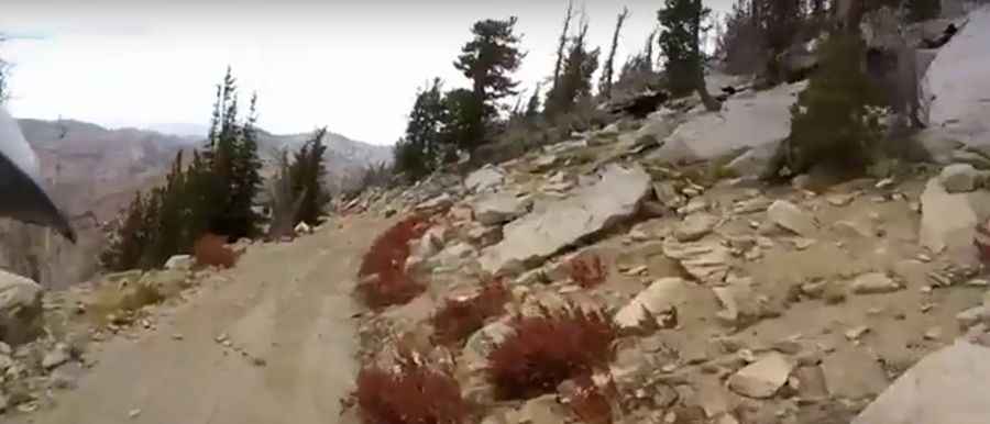
The road to the summit is totally unpaved. It’s called Trinity Mountain Road (129A). It’s a very steep drive. Starting from Forest Road 129, the ascent is 3.54km (2.2 miles) long. Over this distance the elevation gain is 294 meters. The average gradient is 8.30%. A 4x4 vehicle is required.
Is the road to Trinity Mountain open in winter?
Set high in the Trinity Mountains, a subrange of the Boise Mountains, the summit is often snowbound well into June, and snow can keep the road closed into July or longer if traveling north from the pass. The last part of the service road that leads to the active fire lookout on the summit is closed to private vehicles.
Pic&video: Idaho Dual Sport