How to drive the wild road to Toro Peak in California
Toro Peak is a high mountain peak at an elevation of 2.655m (8,710ft) above sea level, located in south-central Riverside County, in the U.S. state of California.
Where is Toro Peak?
The peak is located in the southern part of the US state of California, within the San Bernardino National Forest.
Why is there a road to Toro Peak?
At the summit there are a few communication towers and facilities.
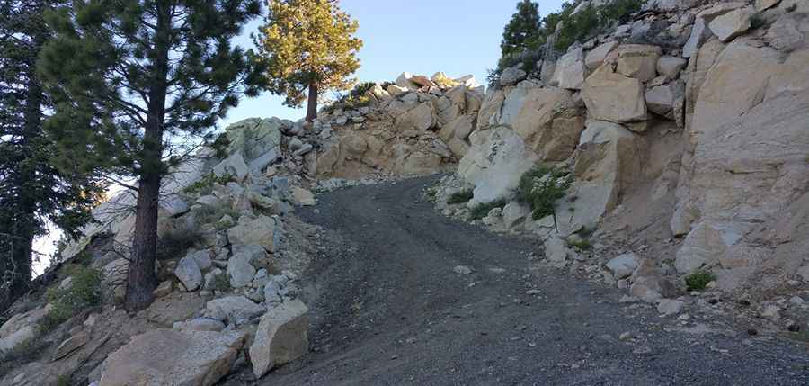
Is the road to Toro Peak unpaved?
The road to the summit is totally unpaved. It’s called Santa Rosa Road (7S02). The road is dirt and moderately bumpy, so high-clearance is mandatory and 4-wheel drive is strongly recommended. It comes to a locked gate around 8,200 ft and from there it is a 500-foot hike to the summit up a rough maintenance road that passes a power generator that provides electricity to the summit.
How challenging is the road to Toro Peak?
There are sections where the road is very narrow so be careful and mindful of oncoming drivers. The last section of road is really steep, loose and rocky. It was cut into the mountain some three decades ago to service a microwave relay station that sits squarely on the mountain's bulldozed top.
How long is the road to Toro Peak?
The road to the summit is pretty steep, hitting a 13% of maximum gradient through some of the ramps. Starting at the paved CA-74, the ascent is 20.43km (12.7 miles) long. Over this distance the elevation gain is 1257 meters. The average gradient is 6.15%.
Is the road to Toro Peak open year-round?
Set high in the Santa Rosa Mountain Range, the road is usually closed each winter if snow and ice create dangerous conditions. It may be closed during times of high fire danger or rainy weather.
Pic: Good Cattitues