Doherty Slide in Oregon: Turn Back Now If You Have A Heart Condition
Doherty Slide is a high mountain ridge at an elevation of 1,904m (6,246ft) above sea level, located in Lake County, in the U.S. state of Oregon. Only one step in a wrong direction can be fatal.
Where is Doherty Slide?
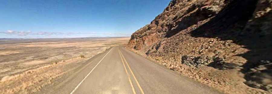
This very dangerous stretch of road, also known as Doherty Rim, is located near the Oregon-Nevada state line overlooking the Warner Valley in the south-central region of Oregon, at the eastern end of the Guano Valley. The ridge was formed by lava extrusions and has been subsequently eroded to produce the present rim.
How long is the road to Doherty Slide?
The road to the summit is totally paved, connecting northwestern Nevada to southern Oregon. It’s called Oregon Route 140. The pass is 175km (109 miles) long, running west-east from US-395 (north of Lakeview in Lake County, Oregon) to NV-140 (south of Denio, in Humboldt County, Nevada).
Is the road to Doherty Slide dangerous?
Located 20 miles east of the town of Adel, a sign near the summit reminds you to "Take Your Time, Don’t Rush, And You’ll Get There Alive". The road is a narrow two-lane state highway, and there's no guardrail, making it a scary mountain cliff road. It is very narrow without shoulders, and if you drive a big rig on it, you must be very careful. There are no guardrails, and the drop-off is 1,000 feet straight down. A final large yellow sign reads, “This Is Your Final Warning! Turn Back Now If You Have A Heart Condition!"
Is the road to Doherty Slide steep?
The road is pretty challenging in the wet or dark (or both). The climb is steep and seems like you will be climbing forever. A sign says: “8 Percent Grade, Three Miles, Last Warning, Trucks Use Low Gear”. Remember, the shoulder of the highway is neighbor to nothingness, a nearly vertical drop to the plateau below, and you'll have your eyes glued to the road.