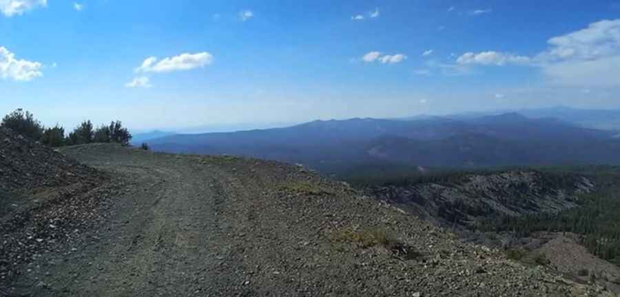
A dirt road to the top of Pelican Butte in Oregon
Pelican Butte is a dormant shield volcano at an elevation of 2,450m (8,037 ft) above sea level, located in Klamath County, in the U.S. state of Oregon. It’s one of the highest roads in Oregon.
Where is Pelican Butte?
The peak is located in the southern part of Oregon, within the Winema National Forest.
What’s at the summit of Pelican Butte?
At the summit, there’s a fire lookout tower built in 1935. The current 20-foot all-steel observation tower, constructed in 1986 by the local cable TV company to accommodate radio equipment, is now only used during emergencies. The views from the summit are incredible. You can enjoy views of the Sky Lakes and Mountain Lakes Wildernesses, Mt. McLoughlin, Upper Klamath Lake, and the Klamath Basin.
Is the road to Pelican Butte unpaved?
The unpaved road to the summit is steep, rocky, narrow, switchbacked, and occasionally muddy. It’s called NF-980 (Pelican Butte Road). The road zigzags up the west flanks of the volcano to the summit. From around 6,000 feet, you’ll need a high-clearance 4WD vehicle. The road is challenging due to its steepness.
How long is the road to Pelican Butte?
Starting from NF-3651, the ascent is 7.24 km (4.5 miles) long. Over this distance, the elevation gain is 683 meters, with an average gradient of 9.43%, hitting a maximum gradient of 13.5% on some sections.
Is the road to Pelican Butte open in winter?
Set high at the southern tip of the Cascade Mountain Range, the road is usually impassable from November through June.
Pic&video: 2512rc