How to drive the unpaved road to Palette Lake in Colorado
Palette Lake is a high mountain lake at an elevation of 3.713m (12,181ft) above sea level, located in Chaffee County, in the US state of Colorado. It’s one of the highest roads of Colorado.
Where is Palette Lake?
The alpine lake, also known as Cave Lake, is located north of Poncha Springs, in the south-central part of Colorado.
Is the road to Palette Lake unpaved?
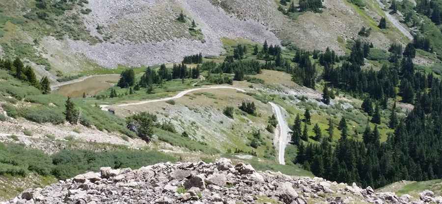
The road to the summit is totally unpaved. It’s locally known as Atlantic Mound Road. It comprises narrow parts and very steep sections. A 4x4 vehicle is required. East of the lake, a gravel road climbs up to 3.891m (12,765ft) above sea level.
How long is the road to Palette Lake?
Starting from County Road 306, the road to the summit is 20.9 km long. Over this distance, the elevation gain is 1130m and the average gradient is 5.40%.
Is the road to Palette Lake open year-round?
Set high in the Rocky Mountains, the road is totally impassable in winters. The road often involves some travel on snow, even in summer. High winds blow here all year long.
Pic: Jason Sprong