An Old Mining Trail to Kuss Peak in Colorado
Kuss Peak is a high mountain peak at an elevation of 4,136m (13,569ft) above sea level, located in Lake County, in the US state of Colorado. It is one of the highest roads in the USA.
Where is Kuss Peak?
The peak is located between Leadville and Alma, in the central part of Colorado, within the Pike National Forest.
Is Kuss Peak worth the drive?
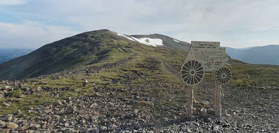
The summit offers superb views. It is definitely worth it. You will enjoy delightful views ranging from nearby neighbors in the Mosquito Gulch basin out to numerous Continental Divide summits and beyond.
Why is it called Kuss Peak?
The peak was officially renamed in early 2013 as Kuss Peak to honor Adolph Kuss Sr., a notable Leadville resident and miner. Formerly, it was known as Repeater Peak.
How challenging is the road to Kuss Peak?
The road to the summit is an old mine trail, totally unpaved and pretty hairy. It is a two-way road, although it is tight in some spots and may require careful maneuvering to pass oncoming traffic. The journey requires a challenging route full of steep grades and scary narrow cliff faces. It is a very rough, narrow unpaved route. Among steep cliffs with stunning views, there are multiple stream crossings and portions with challenging terrain. It is for experienced drivers with proper vehicles only. Drive at your own risk. A 4x4 vehicle with good ground clearance is required.
How long is the road to Kuss Peak?
Starting from the iconic Mosquito Pass, the road to the summit is 1.5 km (0.93 miles) long. Over this distance, the elevation gain is 109 m, and the average gradient is 7.26%. It is one of the highest roads in Colorado.
Is the road to Kuss Peak open in winter?
Set high in the Mosquito Range of the Rocky Mountains, the road is totally impassable in winter. The best time to attempt the pass is between late July and early September.
Pic: Kristofer Carlstedt