Exploring the Breathtaking Beartooth Highway: A Scenic Adventure
The Beartooth Highway is a thrilling adventure. Part of the U.S. Highway 212, the road offers stunning views of the Absaroka and Beartooth Mountains. This spectacular mountain road spans Wyoming and Montana and climbs up to 10,964 feet above sea level. It’s one of the highest roads in Wyoming and Montana.
Is the Beartooth Highway paved?
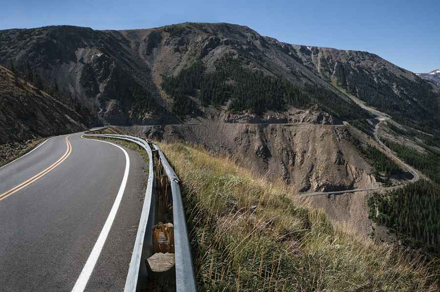
This winding and high mountain road, part of U.S. Route 212, is completely paved, tracing the border between Montana and Wyoming in the Beartooth Mountains. It offers numerous photo spots as it winds its way through southwest Montana and northwest Wyoming, leading into Yellowstone National Park at its northeast entrance.
How long is Beartooth Highway?
Running along the border of Montana and Wyoming, the road is 67 miles (107km) long, from Red Lodge, the county seat of Carbon County in Montana, to Cooke City in Park County, Montana.
How challenging is it to drive Beartooth Highway?
The road, with a series of turns and steep switchbacks, tops out at 10,964 feet above sea level. It has awesome corners and typically experiences low traffic.
How long does it take to ride the Beartooth Highway?
Driving the road without stopping typically takes most people between 3 and 4 hours. However, due to its beauty and sweeping views, allow half a day to enjoy the route. Over the years, Beartooth Highway has become a go-to destination for road-tripping motorcyclists and adventurous cyclists.
When was the Beartooth Highway built?
The Beartooth Highway was opened to traffic on June 14, 1936.
Is Beartooth Highway worth the drive?
This National Scenic Byways All-American Road has been dubbed "the most beautiful drive in America." With 10,000 mountain lakes, 20 peaks reaching over 12,000 feet in elevation, and 12 national forest campgrounds, the Beartooth Highway is as one of the most scenic drives in the United States. It provides a unique transition from lush forest ecosystems to alpine tundra within just a few miles. The highway, a National Scenic Byways All-American Road, offers breathtaking views of the Absaroka and Beartooth Mountains, along with open high alpine plateaus, glacial lakes, forested valleys, waterfalls, and abundant wildlife. It serves as an easy access point to Yellowstone National Park at its northeast entrance, attracting visitors from around the world.
Is the Beartooth Highway open?
The road, that climbs up to Beartooth Pass, is the highest elevation highway in Wyoming and Montana. It cuts through some of the country's most extreme terrain, surrounded by 20 mountain peaks exceeding 12,000 feet. It’s usually open from mid-May through mid-October. However, be prepared for unpredictable weather conditions, including snowstorms even in summer, strong winds, and severe thunderstorms.
Image credit: Depositphotos