How to drive the unpaved road to Table Rock Mountain in Washington?
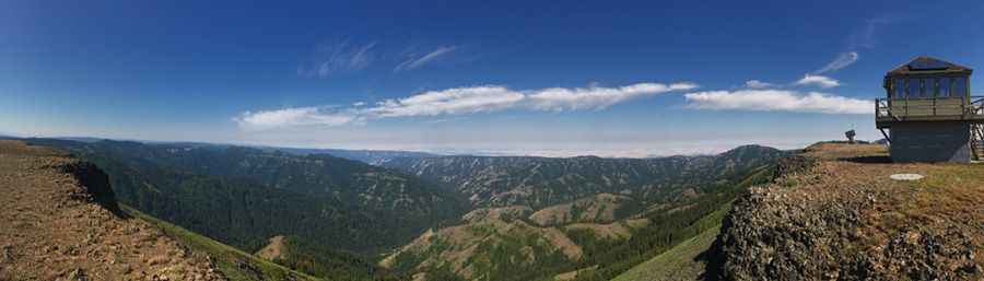
Table Rock Mountain is a high mountain peak reaching an elevation of 1,908 meters (6,259 ft) above sea level in Columbia County, southeastern Washington, USA. Located deep within the Umatilla National Forest near the Oregon border, the mountain features an unpaved forest access road climbing to a historic fire lookout tower at the summit.
| Road facts: Table Rock Mountain | |
|---|---|
| Location | Columbia County (Umatilla National Forest), Washington (USA) |
| Route Designation | Kendall Skyline Road (Forest Service Road 64) |
| Distance | 46.6 km (29 miles) from Dayton |
| Elevation | 1,908 m (6,259 ft) above sea level |
| Surface | Paved to Bluewood Ski Area; unpaved dirt/gravel beyond |
| Vehicle Recommendations | High-clearance 4x4 vehicle recommended |
| Access Status | Seasonal (Unplowed in winter; opens mid-July to late fall) |
Where is Table Rock Mountain located?
The peak is located in the Blue Mountains of southeastern Washington, near the Oregon state line. It sits within the Umatilla National Forest, accessible from either Dayton to the north or Walla Walla to the west.
Why is there a road to Table Rock Mountain?
The road was built to access a high-altitude fire lookout station at the summit. First erected in 1929 and rebuilt in 1949, the original concrete base remains intact today beneath the upper lookout cabin, which underwent structural updates in 1989.
How to drive to Table Rock Mountain?
Starting from Dayton, the route spans 29 miles. Pavement extends up to the Bluewood Ski Area, where the road transitions onto Kendall Skyline Road (Forest Service Road 64). Beyond the ski resort, the route is unpaved and variable, with deep ruts, sharp rocks, and fallen tree limbs. A high-clearance vehicle is strongly recommended. Alternatively, a southern approach from Walla Walla also requires a high-clearance 4WD vehicle.
Is the road to Table Rock Mountain open year-round?
No. Set high in the Blue Mountains, Forest Service Road 64 is unplowed throughout winter and early spring. Snowpack accumulates heavily across the peak and does not recede enough to allow vehicle transit until mid-July.
Pic: Lou Smith