Sherman Pass is Washington’s highest maintained road
Sherman Pass is a high mountain pass at an elevation of 1,684m (5,524ft) above sea level, located in Ferry County, in the U.S. state of Washington. It is said to be the highest pass in the state maintained all year.
Why is it called Sherman Pass?
Located in the northeastern part of Washington, and surrounded by stunning scenery with few travelers, much of the drive is on the Colville National Forest. This byway follows a historic route used by Native Americans as they made their way to the fishing grounds of the Columbia River. Later, the trail became a pioneer wagon route and was named after Civil War General William T. Sherman, who passed through the area in 1883.
Is the road through Sherman Pass paved?
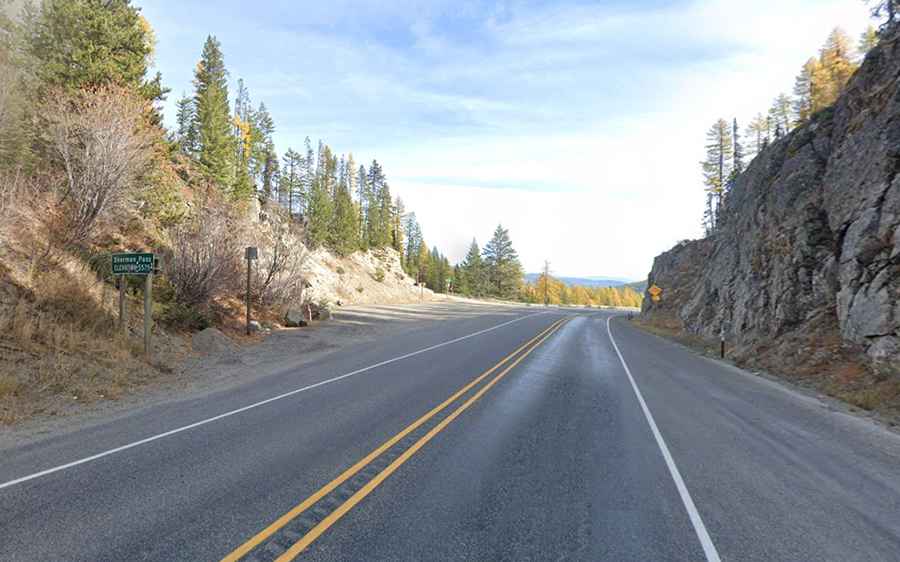
Set high in the Colville National Forest, the road to the summit is totally paved but steep in parts. It’s called State Route 20 (Sherman Pass Scenic Byway). The road was entirely paved in the 1950s and has been called "The Most Beautiful Mountain Highway” in the State of Washington.
How long is Sherman Pass in Washington?
The pass is 59km (36.7 miles) long. It begins near the town of Republic on WA-21 and runs east to the town of Kettle Falls on US-395. The drive is highly recommended from late spring to early fall, offering travelers a chance to escape the pressures of civilization for a while.