How to get to Libby Flats Observation Area in the Rocky Mountains of Wyoming?
Libby Flats Observation Area is an observation tower at an elevation of 3,313m (10,869ft) above sea level, located in Albany County, in the US state of Wyoming. It's one of the highest roads of Wyoming.
Where is Libby Flats Observation Area?
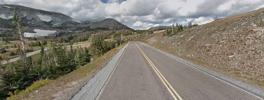
The observation deck, offering a beautiful landscape, is located south of Snowy Range Pass, in the southern part of Wyoming, within Wyoming's Medicine Bow National Forest. The tower marks the highest point on the road along the scenic byway, and it’s a short walk from the parking area.
Is Libby Flats Observation Area worth the drive?
Expect fierce winds at the summit. The tower provides views south to Rocky Mountain National Park, west toward Medicine Bow Peak, the Sierra Madre Mountains, and Mt. Zirkel Wilderness Area, and east toward the Laramie Mountains.
Is the road to Libby Flats Observation Area paved?
The road to the observation deck, built by the CCC, is a two-lane paved road suitable for all vehicles. It’s called Wyoming Highway 130 (also known as Snowy Range Road).
Is the road to Libby Flats Observation Area open in winter?
Set high in the Rocky Mountains, the road to the observation tower is closed for the season in mid-November and traditionally reopens with the help of snowplows before Memorial Day weekend.